
Ramallah & Al-Bireh Governorate: villages, population and land
From Qushan data. Last updated 19 November 2026.
Ramallah & Al-Bireh Governorate is one of the governorates of the West Bank; its centre is the city of Ramallah. It had 328,861 inhabitants in the 2017 census, according to PCBS. It covers 855.2 km², according to PCBS. The census layer holds 83 localities in it, and Qushan's data holds 225,272 land parcels in 1,599 blocks. This page shows the map of the governorate, its towns and villages with their population, what the data holds about its land, its settlement of title, master plans, Areas A, B and C and what the occupation holds in it, and how to reach any parcel in it.
- Map
- Towns and villages
- Population and area
- Refugee camps
- Land and settlement of title
- Master plans
- Areas A, B and C
- Occupation and settlements
- Roads and buildings
- Terrain
- Neighbouring governorates
- External links
- Reaching a parcel
- Sources
- Area (2021)
- 855.2 km²
- Population (2017 census)
- 328,861
- Localities
- 83
- Land parcels
- 225,272
- Blocks
- 1,599
- Buildings (1997–2016)
- 42,206
Area: PCBS; Population: PCBS; other figures: Qushan, from the Ministry of Local Government geospatial portal, snapshot 16 November 2026.
Map of Ramallah & Al-Bireh Governorate and its localities
Open Ramallah & Al-Bireh Governorate on the map
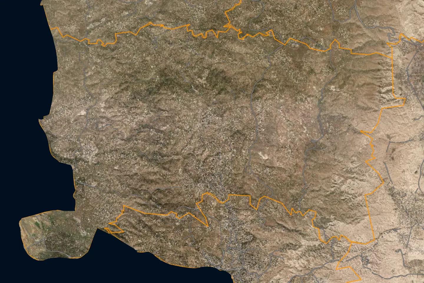
Towns and villages of Ramallah & Al-Bireh Governorate
The 2017 census localities layer holds 83 localities in Ramallah & Al-Bireh Governorate, listed here from the most populous. The population is what the layer states for each locality; the sum of these counts is not necessarily the official figure for the governorate.
| Locality | Population (2017 census) |
|---|---|
| Al Birehالبيرة | 45,975 |
| Ramallahرام الله | 38,998 |
| Beituniyaبيتونيا | 26,604 |
| Beit Liqyaبيت لقيا | 9,304 |
| Al Jalazun Campمخيم الجلزون | 8,201 |
| Kharbatha al Misbahخربثا المصباح | 6,366 |
| Silwadسلواد | 6,342 |
| Qibyaقبيا | 6,090 |
| Locality | Population (2017 census) |
|---|---|
| Birzeitبيرزيت | 5,878 |
| Sinjilسنجل | 5,742 |
| Shuqbaشقبا | 5,459 |
| Al Mazra'a al Qibliyaالمزرعة القبلية | 5,180 |
| Ni'linنعلين | 5,118 |
| Beit 'Ur at Tahtaبيت عور التحتا | 5,040 |
| Al Am'ari Campمخيم الأمعري | 4,725 |
| Kafr Ni'maكفر نعمة | 4,659 |
The other 67 localities
| Locality | Population (2017 census) |
|---|---|
| Deir Jarirدير جرير | 4,469 |
| Khirbet Abu Falahخربة أبو فلاح | 4,394 |
| Saffaصفا | 4,374 |
| Beit Reemaبيت ريما | 4,335 |
| Kobarكوبر | 4,320 |
| Deir Abu Mash'alدير أبو مشعل | 4,233 |
| Deir Dibwanدير دبوان | 4,169 |
| Al Mazra'a ash Sharqiyaالمزرعة الشرقية | 4,063 |
| 'Abweinعبوين | 3,496 |
| Kharbatha Bani Harithخربثا بني حارث | 3,471 |
| Beitilluبيتللو | 3,465 |
| Qarawat Bani Zeidقراوة بني زيد | 3,415 |
| Deir 'Ammarدير عمار | 3,353 |
| Beit Siraبيت سيرا | 3,343 |
| Rantisرنتيس | 3,179 |
| 'Aruraعارورة | 3,107 |
| Dura al Qar'دورا القرع | 3,032 |
| Kafr Malikكفر مالك | 2,946 |
| Jifnaجفنا | 2,919 |
| Al Mughayyirالمغير | 2,872 |
| Deir Ibzi'دير إبزيع | 2,590 |
| 'Ein Yabrudعين يبرود | 2,515 |
| 'Ataraعطارة | 2,492 |
| Turmus'ayyaترمسعيا | 2,464 |
| Deir Qaddisدير قديس | 2,452 |
| Abu Shukheidimابو شخيدم | 2,438 |
| Mazari' an Nubaniمزارع النوباني | 2,436 |
| Rammunرمون | 2,405 |
| Beitinبيتين | 2,242 |
| Abu Qashابو قش | 2,237 |
| Deir as Sudanدير السودان | 2,159 |
| 'Abudعابود | 2,153 |
| Bil'inبلعين | 2,137 |
| Burqaبرقة | 2,047 |
| Locality | Population (2017 census) |
|---|---|
| Kafr 'Einكفر عين | 1,958 |
| Ras Karkarراس كركر | 1,956 |
| Deir 'Ammar Campمخيم دير عمار | 1,884 |
| 'Ein 'Arikعين عريك | 1,774 |
| Deir Ghassanaدير غسانة | 1,692 |
| Jammalaجمالا | 1,664 |
| Budrusبدرس | 1,596 |
| Al Lubban al Gharbiاللبن الغربي | 1,566 |
| Al Midyaالمدية | 1,533 |
| At Tiraالطيرة | 1,504 |
| 'Ajjulعجول | 1,402 |
| At Taybaالطيبة | 1,340 |
| Surdaصردا | 1,308 |
| Al Janiyaالجانية | 1,296 |
| Shabtinشبتين | 1,136 |
| Beit 'Ur al Fauqaبيت عور الفوقا | 1,049 |
| 'Ein Siniyaعين سينيا | 925 |
| Qaddura Campمخيم قدورة | 924 |
| Deir Nidhamدير نظام | 876 |
| Badiw al Mu'arrajatبدو المعرجات | 830 |
| 'Ein Qiniyaعين قينيا | 721 |
| Rawabiروابي | 710 |
| Umm Safaأم صفا | 681 |
| Jilijliyaجلجيليا | 632 |
| Burhamبرهام | 583 |
| Yabrudيبرود | 575 |
| An Nabi Salihالنبي صالح | 522 |
| Silwad Campمخيم سلواد | 456 |
| Ad Dohaالدوحة | 209 |
| Jibiyaجيبيا | 156 |
| Imwasعمواس* | — |
| Beit Nubaبيت نوبا* | — |
| Yaluيالو* | — |
Source: the 2017 census localities layer as published on the geospatial portal of the Ministry of Local Government, which the Qushan app shows as "Population density".
The population of the governorates is compared on the population page.
A dash means the layer gives no population for the locality. The list holds Palestinian localities only. Israeli settlements are not part of it; what concerns them is in the occupation section below.
Population and area of Ramallah & Al-Bireh Governorate
Figures of the Palestinian Central Bureau of Statistics (PCBS) for Ramallah & Al-Bireh Governorate:
Refugee camps in Ramallah & Al-Bireh Governorate
The camps that PCBS lists under Ramallah & Al-Bireh Governorate, with its mid-2017 population estimate. This is a mid-year estimate, not the census count, so it differs slightly from the figure in the table above.
| Camp | Population (mid-2017 estimate) |
|---|---|
| Silwad Camp | 452 |
| Deir A’mmar Camp | 1,868 |
| Al Jalazun Camp | 8,130 |
| Al Ama’ri Camp | 4,684 |
| Qaddura Camp | 916 |
Source: PCBS, 2017.
Land and settlement of title
Qushan's data for Ramallah & Al-Bireh Governorate holds 225,272 land parcels in 1,599 blocks. Each parcel has its boundary on the map, its block number and parcel number, its area, its land settlement type, and its land use in the master plan where an approved plan exists.
Parcels by land settlement type
For each parcel the app states its land settlement type, that is, the state of settlement of title. The parcels in Ramallah & Al-Bireh Governorate divide as follows:
| Settlement type | Parcels |
|---|---|
| Palestinian settlement of title, completed تسوية فلسطينية منتهية | 135,495 |
| Jordanian settlement of title, completed تسوية أردنية منتهية | 59,683 |
| Jordanian settlement of title, not completed تسوية أردنية غير منتهية | 16,631 |
The figures are what the app's data held on 13 November 2026; they are not official statistics. The data does not include all unsettled land, because the parcels of some blocks are not yet drawn in the source.
What these types mean, and their effect, is in the land settlement and tabu guide.
Share of parcels with completed settlement
Settlement of title is completed for 88.1% of the parcels of Ramallah & Al-Bireh Governorate in the parcels layer; the layer counts 163,261 registered parcels covering 607 km².
Source: Qushan, from the Ministry of Local Government geospatial portal, snapshot 16 November 2026.
Completed and uncompleted settlement, by area
Source: Qushan, from the Ministry of Local Government geospatial portal, snapshot 16 November 2026. Survey year: not stated in the source.
| Status | Area | % |
|---|---|---|
| Settlement completed | 476 km² | 78.3 |
| Settlement not completed | 91.6 km² | 15.1 |
| Unspecified | 40.2 km² | 6.6 |
Registered and unregistered land
Source: Qushan, from the Ministry of Local Government geospatial portal, snapshot 16 November 2026. Survey year: not stated in the source.
Shares are of community land in the app's layer, not of the official area of the governorate.
| Status | Area | % |
|---|---|---|
| Registered | 382 km² | 47.3 |
| Not registered | 426 km² | 52.7 |
Localities with the most parcels
Locality names are given in Arabic, as they appear in the app.
| Locality | Parcels |
|---|---|
| ترمسعيا | 12,459 |
| البيرة | 10,762 |
| بيتونيا | 10,100 |
| رام الله | 8,262 |
| خربة ابو فلاح | 7,383 |
| المزرعة القبلية | 7,097 |
| دير ابزيع | 6,928 |
| بيت لقيا | 6,496 |
| كوبر | 6,253 |
| دير دبوان | 6,065 |
| عارورة | 5,795 |
| كفر نعمة | 5,238 |
The data also holds parcels in: بيت عور التحتا، سنجل، عبوين، مزارع النوباني، كفر مالك، خربثا المصباح، صفا، رنتيس، بيرزيت، المزرعه الشرقية، سلواد، بيت ريما، بيتللو، دير عمار، نعلين، دير غسانة، الطيبة / رام الله، عابود، كفر عين، جفنا، دير السودان، دير جرير، رمون، عطارة، عين يبرود، جلجليا، اللبن الغربي، قراوة بني زيد، جمالا، عجول، راس كركر، شقبا، بلعين، الجانيه، دير قديس، بير زيت، المغير، ابو قش، خربثا بني حارث، الطيرة، روابي، ام صفا، بيتين، دورا القرع، برقا-رام الله، عين عريك، جيبيا، سردا، المغير - رام الله، عين سينيا، مديا، جلجيليا، دير نظام، سرده، ابو شخيدم، النبي صالح، يبرود، دير ابو مشعل، برهام، بيت سيرا، بيت عور الفوقا، صردا، قبيا، عين قينيا، عروره، الطيبة، المديا.
Source: Qushan, from the Ministry of Local Government geospatial portal, snapshot 13 November 2026.
Master plans and land use
| Item | Value |
|---|---|
| Land inside an approved master plan | 154 km² |
| Plans deposited for public objection | 52.4 km² |
The source states no survey year for these figures.
Source: Qushan, from the Ministry of Local Government geospatial portal, snapshot 16 November 2026.
Largest land-use classes by area
Source: Qushan, from the Ministry of Local Government geospatial portal, snapshot 16 November 2026. Survey year: not stated in the source.
Class names are shown in Arabic, as the source publishes them.
| Class | Area |
|---|---|
| سكن أ | 23 km² |
| سكن ب | 16.6 km² |
| شارع مصدق | 7.91 km² |
| سكن ب | 7.7 km² |
| سكن أ | 7.67 km² |
| شارع مصدق | 6.85 km² |
| سكن ج | 3.53 km² |
| سكن فلل | 2.35 km² |
| سكن ريفي | 2.07 km² |
| سكن ج | 1.92 km² |
The approved plans of Ramallah & Al-Bireh Governorate use 151 classes; the table shows the ten largest.
What the classes mean, and the building rules, are in the master plans and residential classes guide.
Areas A, B and C
How the community land of Ramallah & Al-Bireh Governorate divides among the Oslo classifications. Shares are of community land in the app's layer, not of the official area of the governorate.
Source: Qushan, from the Ministry of Local Government geospatial portal, snapshot 16 November 2026. Survey year: 1995.
| Classification | Area | % |
|---|---|---|
| Area A | 95.2 km² | 11.8 |
| Area B | 210 km² | 26.0 |
| Area C | 503 km² | 62.3 |
What each classification means is in the guide to Areas A, B and C.
Occupation and settlements
What the published layers state about Israeli settlements and military sites inside Ramallah & Al-Bireh Governorate. Each figure carries its survey year and describes that year, not today.
| Item | Value | Survey year |
|---|---|---|
| Fenced area of Israeli settlements | 24.9 km² | 2016 |
| Settlement outposts | 17 | not stated in the source |
| Settlement industrial areas | 4 | 2016 |
| Military bases | 10 | not stated in the source |
| Road length under Israeli control | 220 km | 2014–2016 |
Source: Qushan, from the Ministry of Local Government geospatial portal, snapshot 16 November 2026.
Settler population
Source: Qushan, from the Ministry of Local Government geospatial portal, snapshot 16 November 2026. Survey year: 2014.
| Year | Settlers |
|---|---|
| 2012 | 101,477 |
| 2013 | 107,394 |
| 2014 | 113,773 |
Where the settlements, the wall and the checkpoints lie on the map is in the guide to settlements, the wall and checkpoints.
Roads and buildings
| Item | Value | Survey year |
|---|---|---|
| Classified road length | 617 km | 2014–2016 |
| Roads needing full rehabilitation | 59.3 km | 2014–2016 |
| Buildings | 42,206 | 1997–2016 |
| Building footprint | 7.96 km² | 1997–2016 |
| Mosques | 206 | not stated in the source |
| Documented place names | 2,905 | not stated in the source |
Source: Qushan, from the Ministry of Local Government geospatial portal, snapshot 16 November 2026.
Terrain
The lowest elevation in Ramallah & Al-Bireh Governorate is 150 m below sea level and the highest 1,000 m above sea level, according to the contour lines in the source.
- Lowest elevation (below sea level)
- 150 m
- Highest elevation
- 1,000 m
Source: Qushan, from the Ministry of Local Government geospatial portal, snapshot 16 November 2026. Survey year: not stated in the source.
Neighbouring governorates
By the governorate outlines in the app, Ramallah & Al-Bireh Governorate borders: Jerusalem, Jericho & Al-Aghwar, Salfit, Nablus.
Pages of the other governorates: Jenin, Tubas, Tulkarm, Qalqilya, Bethlehem, Hebron, North Gaza, Gaza, Deir al-Balah, Khan Yunis, Rafah. The governorates are compared in the land statistics and on the land maps by governorate page.
External links
Reaching a parcel in Ramallah & Al-Bireh
- Open the map and press the bar «بحث عن قطعة» (“search for a parcel”).
- Choose the governorate: رام الله والبيرة, then the village, then the block.
- Enter the parcel number and press «بحث و تقريب» (“search and zoom”).
The full steps, and what to do when you do not know the number, are in the guide to finding a parcel by block and parcel number.
What you find for each parcel
- Record: locality, block, parcel number, area, land settlement type and Area classification.
- Zoning: land use in the master plan and the guidance building rules. Details are in the master plans and residential classes guide.
- Surroundings: length of road frontage, distance from the wall and from the nearest Israeli settlement, and nearby services.
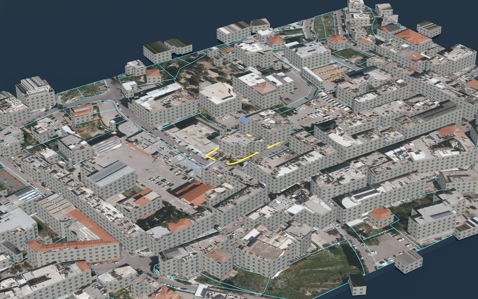
- Outputs: a survey plan in DXF, a PDF report and a 3D model.
Limits and sources
- Qushan is an independent app, not a government product. It shows published administrative and engineering data, and it is not a legal record of ownership.
- Parcel data does not include the owner's name, and the app shows no land for sale and no prices.
- The app's figures are computed from the published layers as they are, with their dates and coverage. They are not official statistics. Some layers are old: the survey year is given with each figure, and the value describes that year, not today.
- Parcels, blocks and settlement types: Qushan, from the Ministry of Local Government geospatial portal, snapshot 13 November 2026.
- Indicators, areas and lengths: Qushan, from the Ministry of Local Government geospatial portal, snapshot 16 November 2026.
- Locality boundaries and their population counts: the 2017 census localities layer as published on the geospatial portal of the Ministry of Local Government.
- PCBS, Population, Housing and Establishments Census 2017: Final Results Summary (updated July 2018), Table 2, p. 71 (2017).
- PCBS, Estimated Population in Palestine Mid-Year by Governorate, 1997-2026 (2026).
- PCBS, Area, Population and Population Density in Palestine by Governorate, 2021 (area from Ministry of Local Government, 2017) (2021).
- PCBS, Projected Mid-Year Population by Locality 2017-2026 (rows named Camp) (2017).
Qushan — the parcel data shown is administrative and geometric, and is not a legal record of ownership.