
Jenin Governorate: villages, population and land
From Qushan data. Last updated 19 November 2026.
Jenin Governorate is one of the governorates of the West Bank; its centre is the city of Jenin. It had 314,866 inhabitants in the 2017 census, according to PCBS. It covers 583.7 km², according to PCBS. The census layer holds 84 localities in it, and Qushan's data holds 66,225 land parcels in 1,027 blocks. This page shows the map of the governorate, its towns and villages with their population, what the data holds about its land, its settlement of title, master plans, Areas A, B and C and what the occupation holds in it, and how to reach any parcel in it.
- Map
- Towns and villages
- Population and area
- Refugee camps
- Land and settlement of title
- Master plans
- Areas A, B and C
- Occupation and settlements
- Roads and buildings
- Terrain
- Neighbouring governorates
- External links
- Reaching a parcel
- Sources
- Area (2021)
- 583.7 km²
- Population (2017 census)
- 314,866
- Localities
- 84
- Land parcels
- 66,225
- Blocks
- 1,027
- Buildings (1997–2016)
- 37,674
Area: PCBS; Population: PCBS; other figures: Qushan, from the Ministry of Local Government geospatial portal, snapshot 16 November 2026.
Map of Jenin Governorate and its localities
Open Jenin Governorate on the map
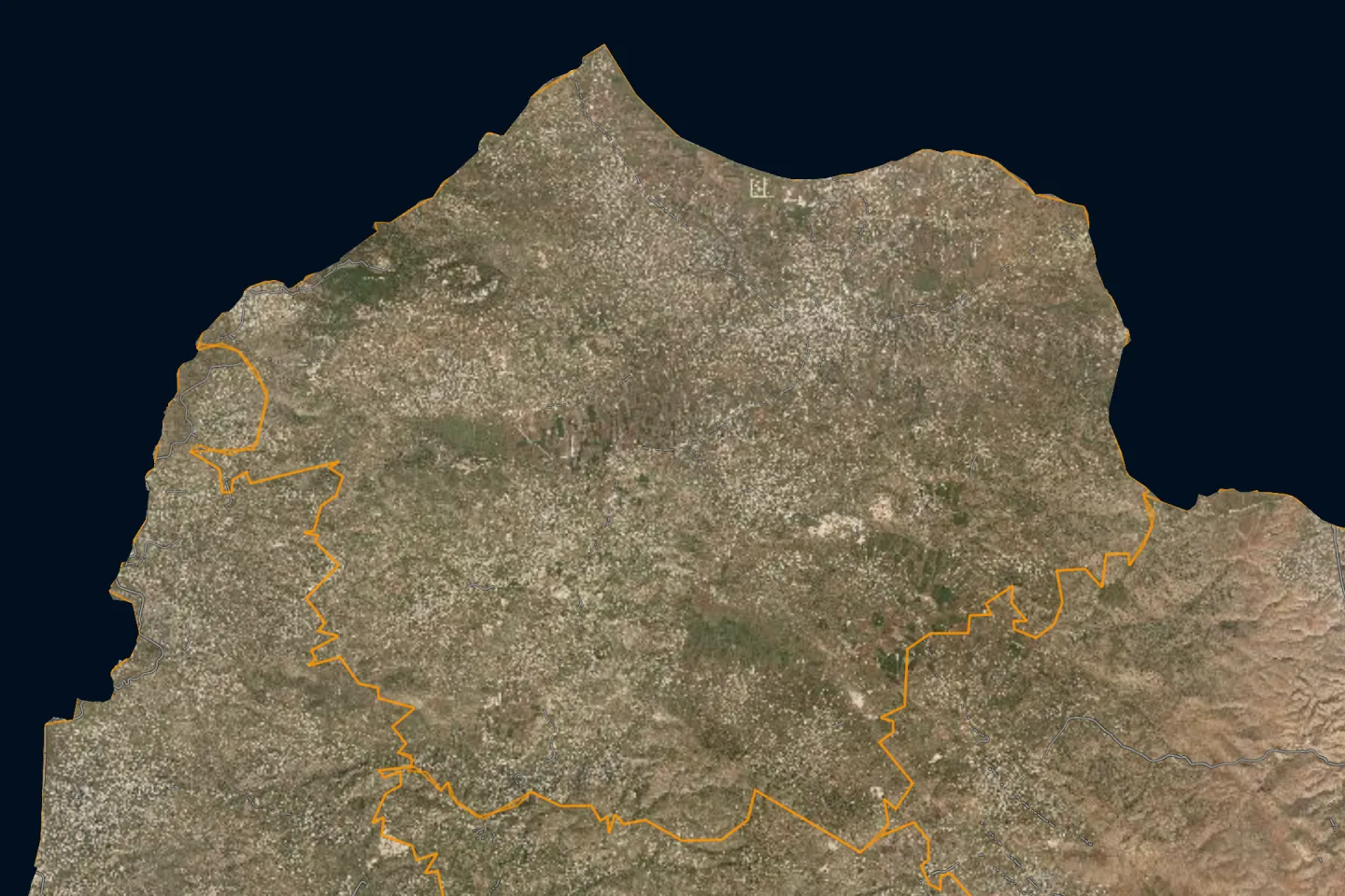
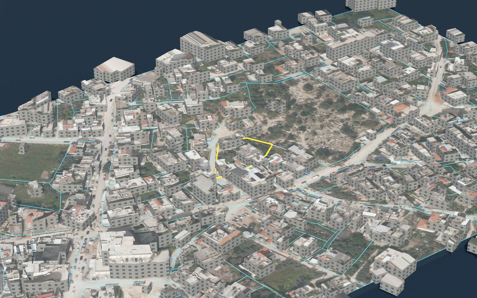
Towns and villages of Jenin Governorate
The 2017 census localities layer holds 84 localities in Jenin Governorate, listed here from the most populous. The population is what the layer states for each locality; the sum of these counts is not necessarily the official figure for the governorate.
| Locality | Population (2017 census) |
|---|---|
| Jeninجنين | 49,908 |
| Qabatiyaقباطية | 24,439 |
| Al Yamunاليامون | 20,774 |
| Ya'badيعبد | 16,012 |
| Arrabaعرابة | 11,479 |
| Silat al Harithiyaسيلة الحارثية | 11,449 |
| Jenin Campمخيم جنين | 10,417 |
| Jaba'جبع | 10,413 |
| Locality | Population (2017 census) |
|---|---|
| Kafr Ra'iكفر راعي | 8,471 |
| Meithalunميثلون | 8,321 |
| Silat adh Dhahrسيلة الظهر | 7,406 |
| Birqinبرقين | 7,126 |
| Deir Abu Da'ifدير ابو ضعيف | 7,045 |
| Kafr Danكفر دان | 6,591 |
| 'Ajjaعجة | 6,162 |
| Sirisسيريس | 6,020 |
The other 68 localities
| Locality | Population (2017 census) |
|---|---|
| Al Judeidaالجديدة | 5,950 |
| Sanurصانور | 5,036 |
| Barta'a ash Sharqiyaبرطعة الشرقية | 4,792 |
| Faqqu'aفقوعة | 4,410 |
| Al Fandaqumiyaالفندقومية | 4,265 |
| Az Zababidaالزبابدة | 4,261 |
| 'Aninعانين | 4,216 |
| Rabaرابا | 3,915 |
| Rummanaرمانة | 3,637 |
| Al Mughayyirالمغير | 3,249 |
| Fahmaفحمة | 3,193 |
| Kufeiritكفيرت | 3,068 |
| Misliyaمسلية | 2,884 |
| Jalbunجلبون | 2,813 |
| Al 'Araqaالعرقة | 2,667 |
| Jalqamusجلقموس | 2,624 |
| 'Arranaعرانة | 2,418 |
| Zububaزبوبا | 2,322 |
| Ash Shuhada (Mothalth Ash Shuhada)الشهداء (مثلث الشهداء) | 2,299 |
| Al Jalamaالجلمة | 2,268 |
| At Taybaالطيبة | 2,215 |
| Mirkaمركة | 2,203 |
| 'Anzaعنزة | 1,938 |
| Bir al Bashaبير الباشا | 1,725 |
| Kafr Qudكفر قود | 1,553 |
| Beit Qad)Al Janubi)بيت قاد (الجنوبي) | 1,538 |
| Al Hashimiyaالهاشمية | 1,305 |
| Ti'innikتعنك | 1,298 |
| Zabdaزبدة | 1,251 |
| Al 'Attaraالعطارة | 1,244 |
| Ar Ramaالرامة | 1,222 |
| Umm at Tutأم التوت | 1,194 |
| Deir Ghazalaدير غزالة | 1,129 |
| Tura al Gharbiyaطورة الغربية | 1,053 |
| Locality | Population (2017 census) |
|---|---|
| 'Arabbunaعربونة | 1,025 |
| Az Zawiyaالزاوية | 1,006 |
| Sirصير | 857 |
| Nazlat ash Sheikh Zeidنزلة الشيخ زيد | 843 |
| Umm Darأم دار | 654 |
| Al Khuljanالخلجان | 616 |
| Wad ad Dabi') 'Aba ash Sharqiya)وادي الضبع (عابا الشرقية) | 571 |
| Al 'Asa'asaالعصاعصة | 571 |
| At Taremالطرم | 496 |
| Dhaher al 'Abedظهر العبد | 467 |
| Umm ar Rihanأم الريحان | 447 |
| Telfitتلفيت | 439 |
| Mashru' Beit Qad )Ash Shamali)مشروع بيت قاد (الشمالي) | 427 |
| Fahma al Jadidaفحمة الجديدة | 388 |
| Imreihaإمريحة | 329 |
| 'Aba (Al Gharbiya)عابا )الغربية) | 325 |
| Al Mutillaالمطلة | 320 |
| Ad Damayraالضمايرة | 247 |
| Tura ash Sharqiyaطورة الشرقية | 233 |
| Al Mansuraالمنصورة | 222 |
| Dhaher al Malihظهر المالح | 195 |
| Wadi Du'oqوادي دعوق | 170 |
| Khirbet 'Abdallah al Yunisخربة عبد الله اليونس | 167 |
| Tanninتنين | 164 |
| Al Hafira (Hafirat Arraba)الحفيرة (حفيرة عرابة) | 88 |
| As Sa'aidaالسعايدة | 87 |
| Al Jarbaالجربا | 63 |
| Al Kufeirالكفير | 57 |
| Al Jameelatالجميلات | 51 |
| Khirbet al Muntar al Gharbiyaخربة المنطار الغربية | 38 |
| Khirbet Surujخربة سروج | 35 |
| Khirbet al Muntar ash Sharqiyaخربة المنطار الشرقية | 33 |
| Firasinفراسين | 27 |
| Kherbet Al Hamamخربة الحمام | 20 |
Source: the 2017 census localities layer as published on the geospatial portal of the Ministry of Local Government, which the Qushan app shows as "Population density".
The population of the governorates is compared on the population page.
The list holds Palestinian localities only. Israeli settlements are not part of it; what concerns them is in the occupation section below.
Population and area of Jenin Governorate
Figures of the Palestinian Central Bureau of Statistics (PCBS) for Jenin Governorate:
Refugee camps in Jenin Governorate
The camps that PCBS lists under Jenin Governorate, with its mid-2017 population estimate. This is a mid-year estimate, not the census count, so it differs slightly from the figure in the table above.
| Camp | Population (mid-2017 estimate) |
|---|---|
| Jenin Camp | 10,327 |
Source: PCBS, 2017.
Land and settlement of title
Qushan's data for Jenin Governorate holds 66,225 land parcels in 1,027 blocks. Each parcel has its boundary on the map, its block number and parcel number, its area, its land settlement type, and its land use in the master plan where an approved plan exists.
Parcels by land settlement type
For each parcel the app states its land settlement type, that is, the state of settlement of title. The parcels in Jenin Governorate divide as follows:
| Settlement type | Parcels |
|---|---|
| Jordanian settlement of title, completed تسوية أردنية منتهية | 43,248 |
| Palestinian settlement of title, completed تسوية فلسطينية منتهية | 15,091 |
| Jordanian settlement of title, not completed تسوية أردنية غير منتهية | 2,594 |
| British settlement of title, completed تسوية انجليزية منتهية | 2,060 |
| British settlement of title, not completed تسوية انجليزية غير منتهية | 343 |
The figures are what the app's data held on 13 November 2026; they are not official statistics. The data does not include all unsettled land, because the parcels of some blocks are not yet drawn in the source.
What these types mean, and their effect, is in the land settlement and tabu guide.
Share of parcels with completed settlement
Settlement of title is completed for 88.4% of the parcels of Jenin Governorate in the parcels layer; the layer counts 62,035 registered parcels covering 583 km².
Source: Qushan, from the Ministry of Local Government geospatial portal, snapshot 16 November 2026.
Completed and uncompleted settlement, by area
Source: Qushan, from the Ministry of Local Government geospatial portal, snapshot 16 November 2026. Survey year: not stated in the source.
| Status | Area | % |
|---|---|---|
| Settlement completed | 450 km² | 77.2 |
| Settlement not completed | 98.9 km² | 17.0 |
| Unspecified | 33.9 km² | 5.8 |
Registered and unregistered land
Source: Qushan, from the Ministry of Local Government geospatial portal, snapshot 16 November 2026. Survey year: not stated in the source.
Shares are of community land in the app's layer, not of the official area of the governorate.
| Status | Area | % |
|---|---|---|
| Registered | 504 km² | 87.8 |
| Not registered | 70.2 km² | 12.2 |
Localities with the most parcels
Locality names are given in Arabic, as they appear in the app.
| Locality | Parcels |
|---|---|
| ميثلون | 8,594 |
| قباطية | 4,024 |
| يعبد | 2,753 |
| جبع-جنين | 2,735 |
| عانين | 2,655 |
| عرابة | 2,554 |
| كفر راعي | 2,448 |
| جنين | 2,389 |
| اليامون | 2,349 |
| سيلة الظهر | 2,235 |
| عرانة | 2,120 |
| برقين | 1,791 |
The data also holds parcels in: عجه، تعنك، صانور، سريس، فقوعة، الفندقومية، الطيبة / جنين، دير ابو ضعيف، عنزا، الجديدة، عربونا، سيلة الحارثية، الزبابدة، مسليا، رابا، ذبوبة، كفر دان، جلبون، المغير، العطارة، برطعة الشرقية، فحمه، صير، دير غزالة، رمانة، جلقموس، مزرعة تنين، عرقه، كفر قود، تلفيت، الجلمه، زبده، الراما، بيت قاد، ام التوت، الهاشمية، نخيل، مركة، جبع، فراسين، زبوبا، كفيرت.
Source: Qushan, from the Ministry of Local Government geospatial portal, snapshot 13 November 2026.
Master plans and land use
| Item | Value |
|---|---|
| Land inside an approved master plan | 124 km² |
| Plans deposited for public objection | 15.8 km² |
The source states no survey year for these figures.
Source: Qushan, from the Ministry of Local Government geospatial portal, snapshot 16 November 2026.
Largest land-use classes by area
Source: Qushan, from the Ministry of Local Government geospatial portal, snapshot 16 November 2026. Survey year: not stated in the source.
Class names are shown in Arabic, as the source publishes them.
| Class | Area |
|---|---|
| سكن أ | 37.8 km² |
| سكن ب | 36.6 km² |
| شارع مصدق | 16.4 km² |
| سكن ج | 11.9 km² |
| سكن زراعي | 2.81 km² |
| منطقة البلدة القديمة | 2.36 km² |
| مباني عامة | 1.91 km² |
| اراضي دولة | 1.59 km² |
| سكن فلل | 1.42 km² |
| منطقة احراش وترفية واستجمام | 1.17 km² |
The approved plans of Jenin Governorate use 72 classes; the table shows the ten largest.
What the classes mean, and the building rules, are in the master plans and residential classes guide.
Areas A, B and C
How the community land of Jenin Governorate divides among the Oslo classifications. Shares are of community land in the app's layer, not of the official area of the governorate.
Source: Qushan, from the Ministry of Local Government geospatial portal, snapshot 16 November 2026. Survey year: 1995.
| Classification | Area | % |
|---|---|---|
| Area A | 282 km² | 49.1 |
| Area B | 103 km² | 18.0 |
| Area C | 189 km² | 33.0 |
What each classification means is in the guide to Areas A, B and C.
Occupation and settlements
What the published layers state about Israeli settlements and military sites inside Jenin Governorate. Each figure carries its survey year and describes that year, not today.
| Item | Value | Survey year |
|---|---|---|
| Fenced area of Israeli settlements | 2.94 km² | 2016 |
| Settlement outposts | 1 | not stated in the source |
| Settlement industrial areas | 1 | 2016 |
| Military bases | 6 | not stated in the source |
| Road length under Israeli control | 29.3 km | 2014–2016 |
Source: Qushan, from the Ministry of Local Government geospatial portal, snapshot 16 November 2026.
Settler population
Source: Qushan, from the Ministry of Local Government geospatial portal, snapshot 16 November 2026. Survey year: 2014.
| Year | Settlers |
|---|---|
| 2012 | 2,308 |
| 2013 | 2,371 |
| 2014 | 2,437 |
Where the settlements, the wall and the checkpoints lie on the map is in the guide to settlements, the wall and checkpoints.
Roads and buildings
| Item | Value | Survey year |
|---|---|---|
| Classified road length | 470 km | 2014–2016 |
| Roads needing full rehabilitation | 66.5 km | 2014–2016 |
| Buildings | 37,674 | 1997–2016 |
| Building footprint | 6.48 km² | 1997–2016 |
| Mosques | 258 | not stated in the source |
| Documented place names | 2,350 | not stated in the source |
Source: Qushan, from the Ministry of Local Government geospatial portal, snapshot 16 November 2026.
Terrain
The lowest elevation in Jenin Governorate is 100 m above sea level and the highest 750 m above sea level, according to the contour lines in the source.
- Lowest elevation
- 100 m
- Highest elevation
- 750 m
Source: Qushan, from the Ministry of Local Government geospatial portal, snapshot 16 November 2026. Survey year: not stated in the source.
Neighbouring governorates
By the governorate outlines in the app, Jenin Governorate borders: Tulkarm, Tubas, Nablus.
Pages of the other governorates: Qalqilya, Salfit, Ramallah & Al-Bireh, Jericho & Al-Aghwar, Jerusalem, Bethlehem, Hebron, North Gaza, Gaza, Deir al-Balah, Khan Yunis, Rafah. The governorates are compared in the land statistics and on the land maps by governorate page.
External links
Reaching a parcel in Jenin
- Open the map and press the bar «بحث عن قطعة» (“search for a parcel”).
- Choose the governorate: جنين, then the village, then the block.
- Enter the parcel number and press «بحث و تقريب» (“search and zoom”).
The full steps, and what to do when you do not know the number, are in the guide to finding a parcel by block and parcel number.
What you find for each parcel
- Record: locality, block, parcel number, area, land settlement type and Area classification.
- Zoning: land use in the master plan and the guidance building rules. Details are in the master plans and residential classes guide.
- Surroundings: length of road frontage, distance from the wall and from the nearest Israeli settlement, and nearby services.
- Outputs: a survey plan in DXF, a PDF report and a 3D model.
Limits and sources
- Qushan is an independent app, not a government product. It shows published administrative and engineering data, and it is not a legal record of ownership.
- Parcel data does not include the owner's name, and the app shows no land for sale and no prices.
- The app's figures are computed from the published layers as they are, with their dates and coverage. They are not official statistics. Some layers are old: the survey year is given with each figure, and the value describes that year, not today.
- Parcels, blocks and settlement types: Qushan, from the Ministry of Local Government geospatial portal, snapshot 13 November 2026.
- Indicators, areas and lengths: Qushan, from the Ministry of Local Government geospatial portal, snapshot 16 November 2026.
- Locality boundaries and their population counts: the 2017 census localities layer as published on the geospatial portal of the Ministry of Local Government.
- PCBS, Population, Housing and Establishments Census 2017: Final Results Summary (updated July 2018), Table 2, p. 71 (2017).
- PCBS, Estimated Population in Palestine Mid-Year by Governorate, 1997-2026 (2026).
- PCBS, Area, Population and Population Density in Palestine by Governorate, 2021 (area from Ministry of Local Government, 2017) (2021).
- PCBS, Projected Mid-Year Population by Locality 2017-2026 (rows named Camp) (2017).
Qushan — the parcel data shown is administrative and geometric, and is not a legal record of ownership.