
Bethlehem Governorate: villages, population and land
From Qushan data. Last updated 19 November 2026.
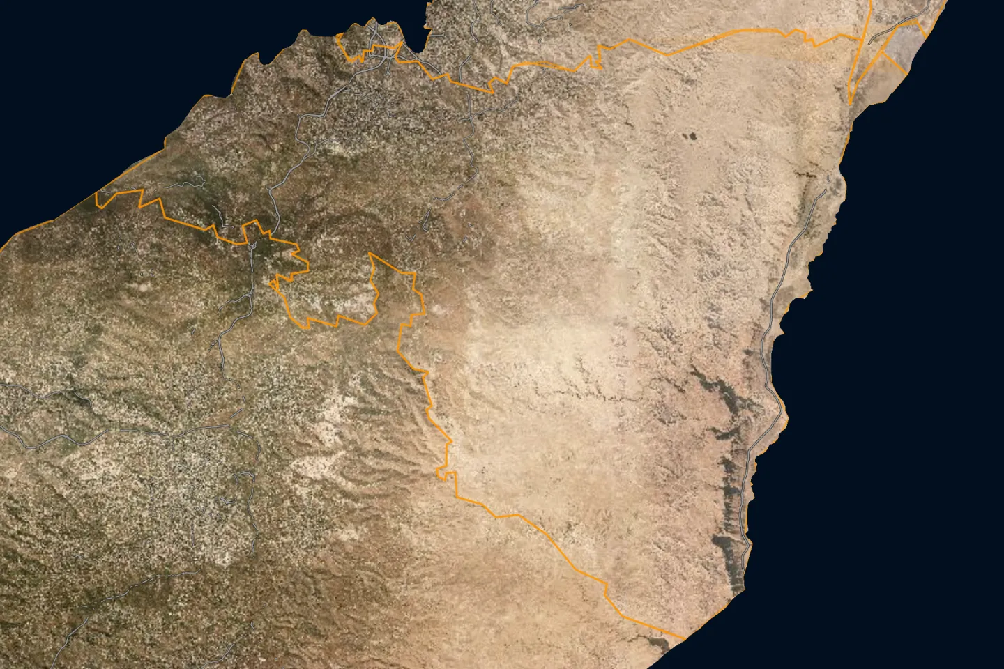
Bethlehem Governorate is one of the governorates of the West Bank; its centre is the city of Bethlehem. It had 217,400 inhabitants in the 2017 census, according to PCBS. It covers 655.4 km², according to PCBS. The census layer holds 51 localities in it, and Qushan's data holds 61,825 land parcels in 431 blocks. This page shows the map of the governorate, its towns and villages with their population, what the data holds about its land, its settlement of title, master plans, Areas A, B and C and what the occupation holds in it, and how to reach any parcel in it.
- Map
- Towns and villages
- Population and area
- Refugee camps
- Land and settlement of title
- Master plans
- Areas A, B and C
- Occupation and settlements
- Roads and buildings
- Terrain
- Neighbouring governorates
- External links
- Reaching a parcel
- Sources
- Area (2021)
- 655.4 km²
- Population (2017 census)
- 217,400
- Localities
- 51
- Land parcels
- 61,825
- Blocks
- 431
- Buildings (1997–2016)
- 21,552
Area: PCBS; Population: PCBS; other figures: Qushan, from the Ministry of Local Government geospatial portal, snapshot 16 November 2026.
Map of Bethlehem Governorate and its localities
Open Bethlehem Governorate on the map
Towns and villages of Bethlehem Governorate
The 2017 census localities layer holds 51 localities in Bethlehem Governorate, listed here from the most populous. The population is what the layer states for each locality; the sum of these counts is not necessarily the official figure for the governorate.
| Locality | Population (2017 census) |
|---|---|
| Bethlehem (Beit Lahm)بيت لحم | 28,591 |
| Al 'Ubeidiyaالعبيدية | 14,460 |
| Beit Fajjarبيت فجار | 13,520 |
| Beit Jalaبيت جالا | 13,484 |
| Beit Sahurبيت ساحور | 13,281 |
| Ad Dohaالدوحة | 12,752 |
| Al Khadrالخضر | 11,960 |
| Ad Duheisha Campمخيم الدهيشة | 8,805 |
| Locality | Population (2017 census) |
|---|---|
| Tuqu'تقوع | 8,767 |
| Nahhalinنحالين | 8,741 |
| Za'taraزعترة | 7,849 |
| Hindaza and Bureid'aهندازة وبريضعة | 7,517 |
| Jannatah (Badd Falouh)جناتا (بد فلوح) | 7,336 |
| Husanحوسان | 7,048 |
| Artasإرطاس | 5,745 |
| Battirبتير | 4,696 |
The other 35 localities
| Locality | Population (2017 census) |
|---|---|
| Dar Salahدار صلاح | 4,588 |
| Ash Shawawraالشواورة | 4,161 |
| 'Ayda Campمخيم عايدة | 2,824 |
| Al Walajaالولجة | 2,671 |
| 'Arab ar Rashayidaعرب الرشايدة | 2,060 |
| Khirbet ad Deirخربة الدير | 2,009 |
| Wadi Rahhalوادي رحال | 1,819 |
| Jurat ash Sham'aجورة الشمعة | 1,778 |
| Marah Rabahمراح رباح | 1,729 |
| Khallet Hamamehخلة حمامة | 1,624 |
| Beit Ta'mirبيت تعمر | 1,596 |
| Al 'Aza Campمخيم العزة | 1,523 |
| Bir Onahبئر عونة | 1,413 |
| Al Maniyaالمنيا | 1,346 |
| Wadi Fukinوادي فوكين | 1,342 |
| Umm Salamunaأم سلمونة | 1,188 |
| Al Jab'aالجبعة | 1,121 |
| Al Fureidisالفريديس | 1,095 |
| Locality | Population (2017 census) |
|---|---|
| Al Ma'saraالمعصرة | 1,085 |
| Marah Ma'allaمراح معلا | 1,072 |
| Wadi an Nisوادي النيص | 1,001 |
| Khallet al Louzaخلة اللوزة | 645 |
| Kisanكيسان | 560 |
| Al Manshiyaالمنشية | 533 |
| Khallet al Haddadخلة الحداد | 507 |
| Al Khasالخاص | 398 |
| Al Halqumالحلقوم | 266 |
| Wadi Immhamidوادي امحيميد | 150 |
| Jub adh Dhibجب الذيب | 144 |
| Khallet Sakariyaخلة سكاريا | 142 |
| Khirbet Tuqu'خربة تقوع | 131 |
| Khallet an Nu'manخلة النعمان | 112 |
| Al Haddadiyaالحدادية | 82 |
| Khallet al Ballutaخلة البلوطه | 74 |
| Khallet 'Afanaخلة عفانة | 59 |
Source: the 2017 census localities layer as published on the geospatial portal of the Ministry of Local Government, which the Qushan app shows as "Population density".
The population of the governorates is compared on the population page.
The list holds Palestinian localities only. Israeli settlements are not part of it; what concerns them is in the occupation section below.
Population and area of Bethlehem Governorate
Figures of the Palestinian Central Bureau of Statistics (PCBS) for Bethlehem Governorate:
Refugee camps in Bethlehem Governorate
The camps that PCBS lists under Bethlehem Governorate, with its mid-2017 population estimate. This is a mid-year estimate, not the census count, so it differs slightly from the figure in the table above.
| Camp | Population (mid-2017 estimate) |
|---|---|
| A’yda Camp | 2,800 |
| Al A’za Camp | 1,510 |
| Ad Duheisha Camp | 8,729 |
Source: PCBS, 2017.
Land and settlement of title
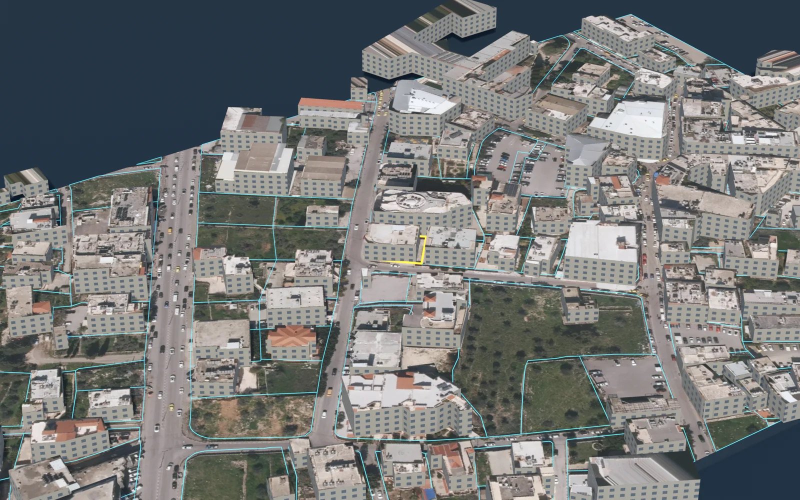
Qushan's data for Bethlehem Governorate holds 61,825 land parcels in 431 blocks. Each parcel has its boundary on the map, its block number and parcel number, its area, its land settlement type, and its land use in the master plan where an approved plan exists.
Parcels by land settlement type
For each parcel the app states its land settlement type, that is, the state of settlement of title. The parcels in Bethlehem Governorate divide as follows:
| Settlement type | Parcels |
|---|---|
| Palestinian settlement of title, completed تسوية فلسطينية منتهية | 52,808 |
| Jordanian settlement of title, not completed تسوية أردنية غير منتهية | 4,145 |
The figures are what the app's data held on 13 November 2026; they are not official statistics. The data does not include all unsettled land, because the parcels of some blocks are not yet drawn in the source.
What these types mean, and their effect, is in the land settlement and tabu guide.
Share of parcels with completed settlement
Settlement of title is completed for 46.9% of the parcels of Bethlehem Governorate in the parcels layer; the layer counts 22,756 registered parcels covering 47.4 km².
Source: Qushan, from the Ministry of Local Government geospatial portal, snapshot 16 November 2026.
Completed and uncompleted settlement, by area
Source: Qushan, from the Ministry of Local Government geospatial portal, snapshot 16 November 2026. Survey year: not stated in the source.
| Status | Area | % |
|---|---|---|
| Settlement not completed | 20.5 km² | 43.3 |
| Settlement completed | 5.4 km² | 11.4 |
| Unspecified | 21.5 km² | 45.3 |
Registered and unregistered land
Source: Qushan, from the Ministry of Local Government geospatial portal, snapshot 16 November 2026. Survey year: not stated in the source.
Shares are of community land in the app's layer, not of the official area of the governorate.
| Status | Area | % |
|---|---|---|
| Registered | 26.5 km² | 4.2 |
| Not registered | 604 km² | 95.8 |
Localities with the most parcels
Locality names are given in Arabic, as they appear in the app.
| Locality | Parcels |
|---|---|
| العبيدية | 9,253 |
| الخضر | 8,506 |
| بيت فجار | 6,195 |
| بيت ساحور | 4,294 |
| بيت لحم | 4,271 |
| جناته | 3,895 |
| هندازة- بريضعة | 3,298 |
| بتير | 2,948 |
| بيت جالا | 2,629 |
| زعتره | 2,278 |
| تقوع | 1,824 |
| واد رحال | 1,785 |
The data also holds parcels in: هندازة - بريضعة، الدوحة، حوسان، نحالين، جورة الشمعة، المالحة، بيت فجار-مراح رباح، بتيير، واد النيص، الولجة، بيت فجار - ام سلمونة، ارطاس، بيت فجار - مراح معلا، بيت فجار-مراح معلا، واد فوكين، دار صلاح، بيت فجار - مراح رباح، وادي رحال، بيت فجار / مراح رباح، بيت فجار-ام سلمونة.
Source: Qushan, from the Ministry of Local Government geospatial portal, snapshot 13 November 2026.
Master plans and land use
| Item | Value |
|---|---|
| Land inside an approved master plan | 56.9 km² |
| Plans deposited for public objection | 15.8 km² |
The source states no survey year for these figures.
Source: Qushan, from the Ministry of Local Government geospatial portal, snapshot 16 November 2026.
Largest land-use classes by area
Source: Qushan, from the Ministry of Local Government geospatial portal, snapshot 16 November 2026. Survey year: not stated in the source.
Class names are shown in Arabic, as the source publishes them.
| Class | Area |
|---|---|
| سكن ب | 15.5 km² |
| سكن أ | 14.1 km² |
| شارع مصدق | 6.87 km² |
| سكن ج | 5.14 km² |
| سكن أ باحكام خاصة | 3.95 km² |
| منطقة صناعية | 1.88 km² |
| سكن ب باحكام خاصة | 1.86 km² |
| منطقة صناعات خفيفة وحرفية | 1 km² |
| مباني عامة | 0.98 km² |
| منطقة البلدة القديمة | 0.95 km² |
The approved plans of Bethlehem Governorate use 62 classes; the table shows the ten largest.
What the classes mean, and the building rules, are in the master plans and residential classes guide.
Areas A, B and C
How the community land of Bethlehem Governorate divides among the Oslo classifications. Shares are of community land in the app's layer, not of the official area of the governorate.
Source: Qushan, from the Ministry of Local Government geospatial portal, snapshot 16 November 2026. Survey year: 1995.
| Classification | Area | % |
|---|---|---|
| Area A | 47.4 km² | 9.3 |
| Area B | 36 km² | 7.1 |
| Area C | 424 km² | 83.6 |
What each classification means is in the guide to Areas A, B and C.
Occupation and settlements
What the published layers state about Israeli settlements and military sites inside Bethlehem Governorate. Each figure carries its survey year and describes that year, not today.
| Item | Value | Survey year |
|---|---|---|
| Fenced area of Israeli settlements | 11.4 km² | 2016 |
| Settlement outposts | 11 | not stated in the source |
| Settlement industrial areas | 2 | 2016 |
| Military bases | 2 | not stated in the source |
| Road length under Israeli control | 135 km | 2014–2016 |
Source: Qushan, from the Ministry of Local Government geospatial portal, snapshot 16 November 2026.
Settler population
Source: Qushan, from the Ministry of Local Government geospatial portal, snapshot 16 November 2026. Survey year: 2014.
| Year | Settlers |
|---|---|
| 2012 | 65,310 |
| 2013 | 68,913 |
| 2014 | 72,814 |
Where the settlements, the wall and the checkpoints lie on the map is in the guide to settlements, the wall and checkpoints.
Roads and buildings
| Item | Value | Survey year |
|---|---|---|
| Classified road length | 408 km | 2014–2016 |
| Roads needing full rehabilitation | 128 km | 2014–2016 |
| Buildings | 21,552 | 1997–2016 |
| Building footprint | 4.16 km² | 1997–2016 |
| Mosques | 167 | not stated in the source |
| Documented place names | 1,152 | not stated in the source |
Source: Qushan, from the Ministry of Local Government geospatial portal, snapshot 16 November 2026.
Terrain
The lowest elevation in Bethlehem Governorate is 350 m below sea level and the highest 975 m above sea level, according to the contour lines in the source.
- Lowest elevation (below sea level)
- 350 m
- Highest elevation
- 975 m
Source: Qushan, from the Ministry of Local Government geospatial portal, snapshot 16 November 2026. Survey year: not stated in the source.
Neighbouring governorates
By the governorate outlines in the app, Bethlehem Governorate borders: Hebron, Jerusalem, Jericho & Al-Aghwar.
Pages of the other governorates: Jenin, Tubas, Tulkarm, Nablus, Qalqilya, Salfit, Ramallah & Al-Bireh, North Gaza, Gaza, Deir al-Balah, Khan Yunis, Rafah. The governorates are compared in the land statistics and on the land maps by governorate page.
External links
Reaching a parcel in Bethlehem
- Open the map and press the bar «بحث عن قطعة» (“search for a parcel”).
- Choose the governorate: بيت لحم, then the village, then the block.
- Enter the parcel number and press «بحث و تقريب» (“search and zoom”).
The full steps, and what to do when you do not know the number, are in the guide to finding a parcel by block and parcel number.
What you find for each parcel
- Record: locality, block, parcel number, area, land settlement type and Area classification.
- Zoning: land use in the master plan and the guidance building rules. Details are in the master plans and residential classes guide.
- Surroundings: length of road frontage, distance from the wall and from the nearest Israeli settlement, and nearby services.
- Outputs: a survey plan in DXF, a PDF report and a 3D model.
Limits and sources
- Qushan is an independent app, not a government product. It shows published administrative and engineering data, and it is not a legal record of ownership.
- Parcel data does not include the owner's name, and the app shows no land for sale and no prices.
- The app's figures are computed from the published layers as they are, with their dates and coverage. They are not official statistics. Some layers are old: the survey year is given with each figure, and the value describes that year, not today.
- Parcels, blocks and settlement types: Qushan, from the Ministry of Local Government geospatial portal, snapshot 13 November 2026.
- Indicators, areas and lengths: Qushan, from the Ministry of Local Government geospatial portal, snapshot 16 November 2026.
- Locality boundaries and their population counts: the 2017 census localities layer as published on the geospatial portal of the Ministry of Local Government.
- PCBS, Population, Housing and Establishments Census 2017: Final Results Summary (updated July 2018), Table 2, p. 71 (2017).
- PCBS, Estimated Population in Palestine Mid-Year by Governorate, 1997-2026 (2026).
- PCBS, Area, Population and Population Density in Palestine by Governorate, 2021 (area from Ministry of Local Government, 2017) (2021).
- PCBS, Projected Mid-Year Population by Locality 2017-2026 (rows named Camp) (2017).
Qushan — the parcel data shown is administrative and geometric, and is not a legal record of ownership.