
Survey plan of a land parcel in DXF
A guide from Qushan. Last updated 19 November 2026.
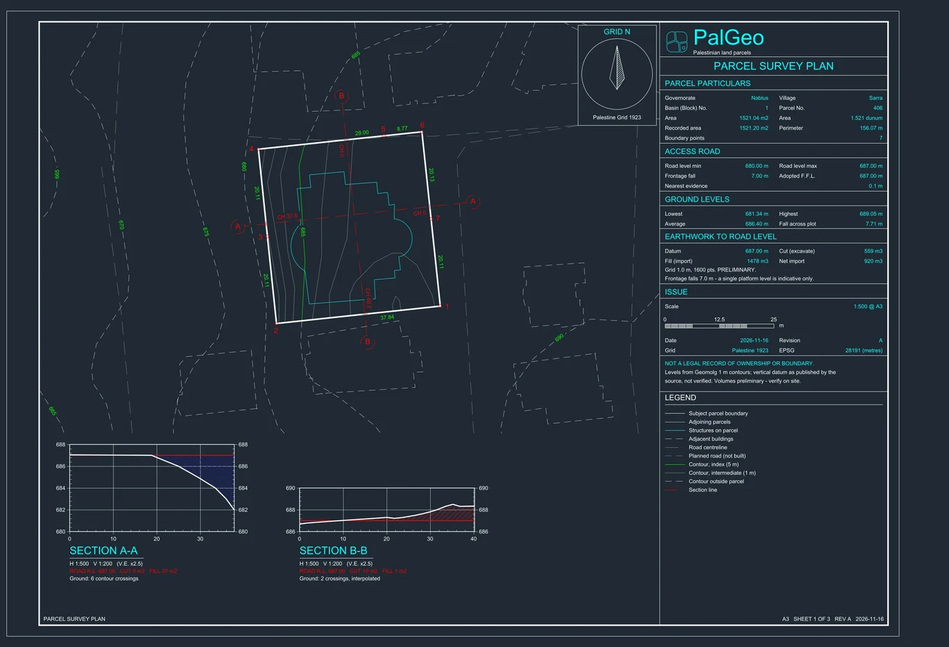
For any parcel Qushan issues a survey and site plan in DXF, which AutoCAD and other drawing programs open directly: the parcel boundary with its side lengths and corner coordinates, together with the terrain and the roads. This page explains what is in the plan, how to issue it, and what it does not replace.
The Qushan interface is in Arabic. Where this page names a button, layer or section, it gives the Arabic label as it appears on screen, with its meaning in English.
What is in the plan
- The parcel boundary with its side lengths and corner coordinates.
- Contour lines.
- Approved roads.
- Two ground sections, and a cut-and-fill calculation.
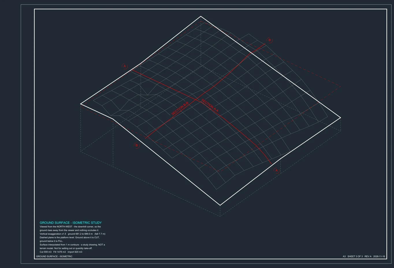
- An isometric view of the ground surface showing the level difference across the parcel.
- Named layers that AutoCAD opens directly.
How to issue the survey plan
- Reach the parcel: by block and parcel number, or by tapping it on the map.
- In its card press «مخطط مساحي» (“survey plan”).
- Download the DXF file and open it in the drawing program.
Survey plans are counted against a monthly allowance in the free account. See the plans section (in Arabic).
How to see the boundary of your land on site
The plan shows the boundary on paper. On site, the app shows the parcel boundary in augmented reality, drawn on the ground in front of the camera, and tells you whether you are inside it. The view relies on GPS and the compass, with an estimated accuracy of 3 to 10 metres, and is not meant for surveying or for legally fixing a boundary.
Limits of what the plan offers
- Qushan is an independent app, not a government product. It shows published administrative and engineering data, and it is not a legal record of ownership.
- The plan is built on the published parcel boundary and is not a field survey. The app states its accuracy on the plan itself.
- An authoritative survey and the fixing of boundaries are the work of a licensed surveyor. The plan prepares that work and does not stand in for it.
The same parcel data feeds the PDF report described in what to check before buying land.
Qushan — the parcel data shown is administrative and geometric, and is not a legal record of ownership.