
Getting a survey plan and exporting it
The survey plan is made straight from the parcel card: the boundary with side lengths and coordinates, contour lines and sections, in a DXF file that CAD programs open. The screenshots are from the iPhone app; the example is parcel 70, block 24009, Nablus. The plan is available to registered accounts.
-
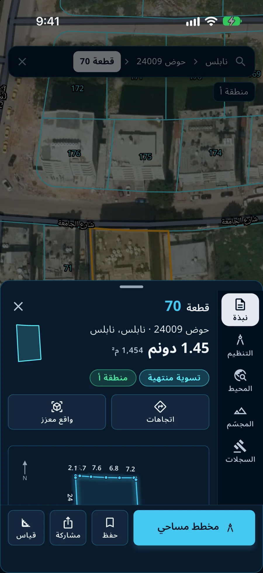
Press «مخطط مساحي»
Open the parcel on the map, by searching for it or pressing it, then press the «مخطط مساحي» (Survey plan) button on its card.
-
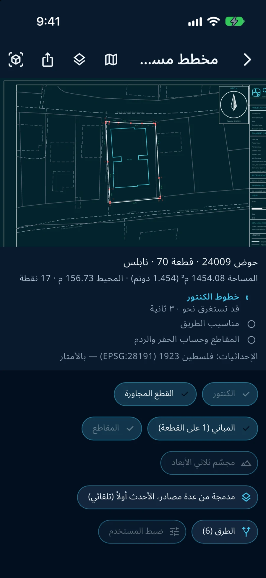
Read the plan
The plan is drawn: the parcel boundary, neighbouring parcels, buildings and roads. Below it are the area in square metres and dunums, the perimeter, and the number of boundary points. Coordinates are Palestine 1923 Grid (EPSG:28191), in metres.
-
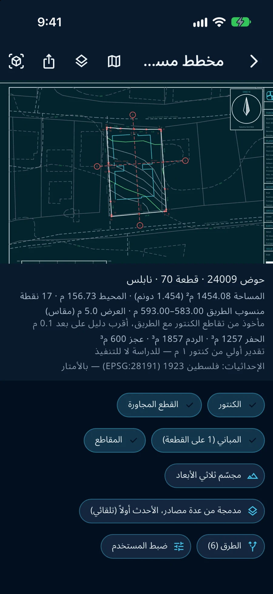
Show contours and sections
The buttons under the plan show and hide its parts: «الكنتور» (contours), «القطع المجاورة» (neighbouring parcels), «المباني» (buildings), «المقاطع» (sections), «الطرق» (roads). With sections on, the app computes the road level and cut-and-fill volumes. These are a first estimate from the contour lines, for study and not for construction.
-
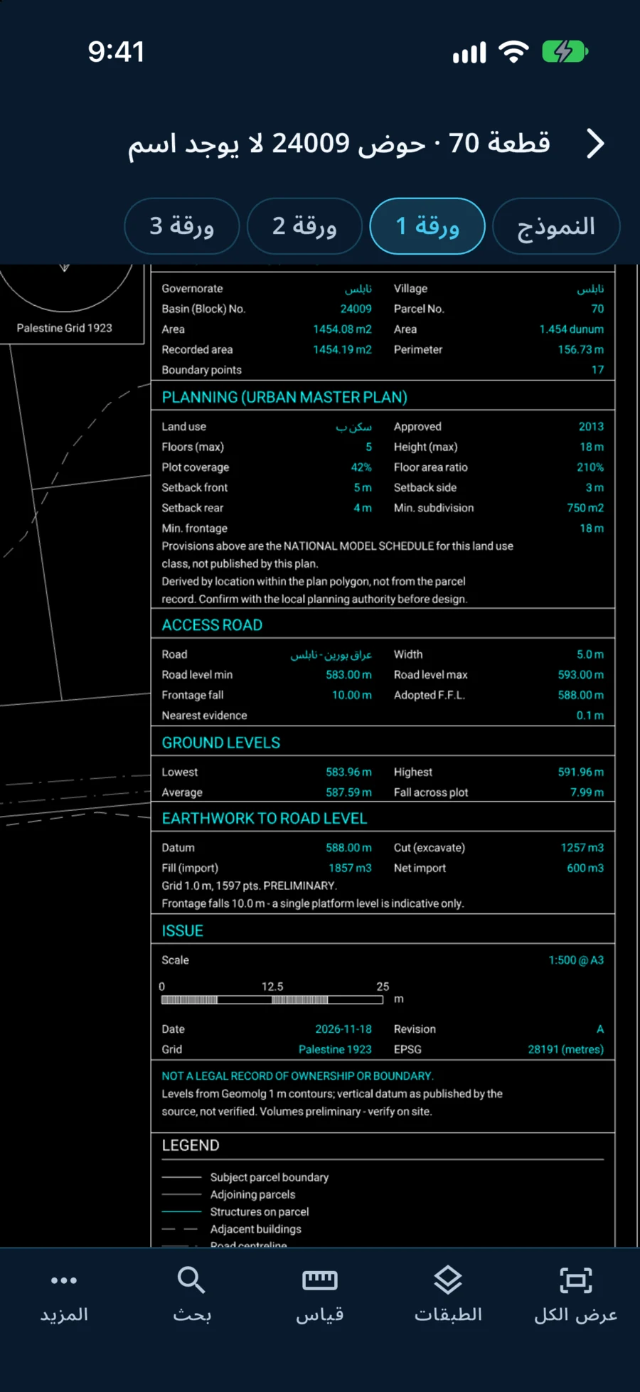
View it in the CAD viewer
From the icons at the top, the plan opens in the CAD viewer inside the app: the sheet with its data table (parcel, planning, access road, levels, earthwork), with tabs for the model and each sheet.
-
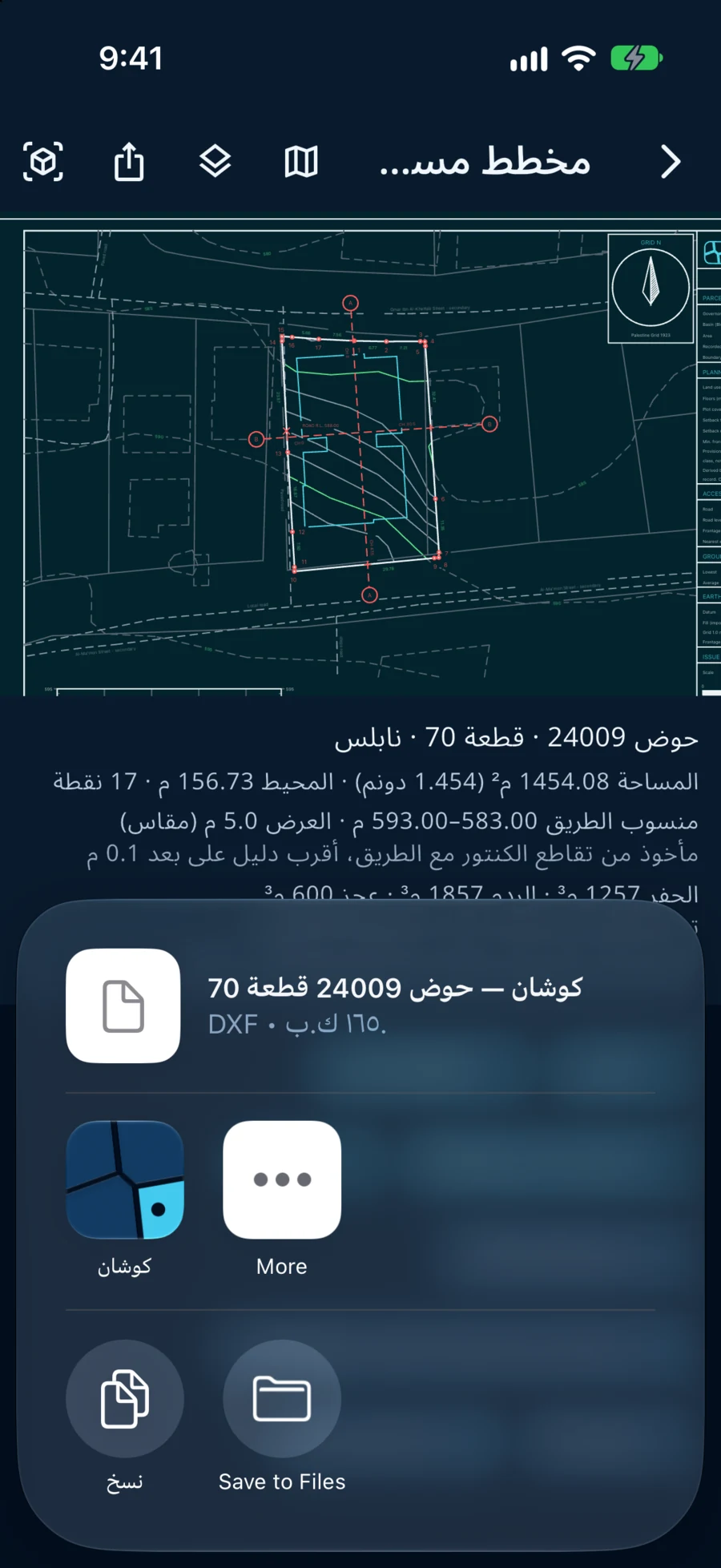
Export the DXF file
Press the export icon at the top. The app prepares a DXF file named after the block and parcel, and the share window opens to save it to Files or send it.
What the file contains, and its layers, is in the survey plan guide. The plan rests on published data; it does not replace a licensed surveyor and is not a legal record of the boundary.
Qushan — the parcel data shown is administrative and geometric, and is not a legal record of ownership.