
Switching layers on and reading the colour key
The map has dozens of layers: plans, roads, Areas A, B and C, rainfall, soil and more. The example switches on «استعمالات الأراضي — تعبئة ملوّنة» (Land use — colour fill) over Huwwara and Beita.
-
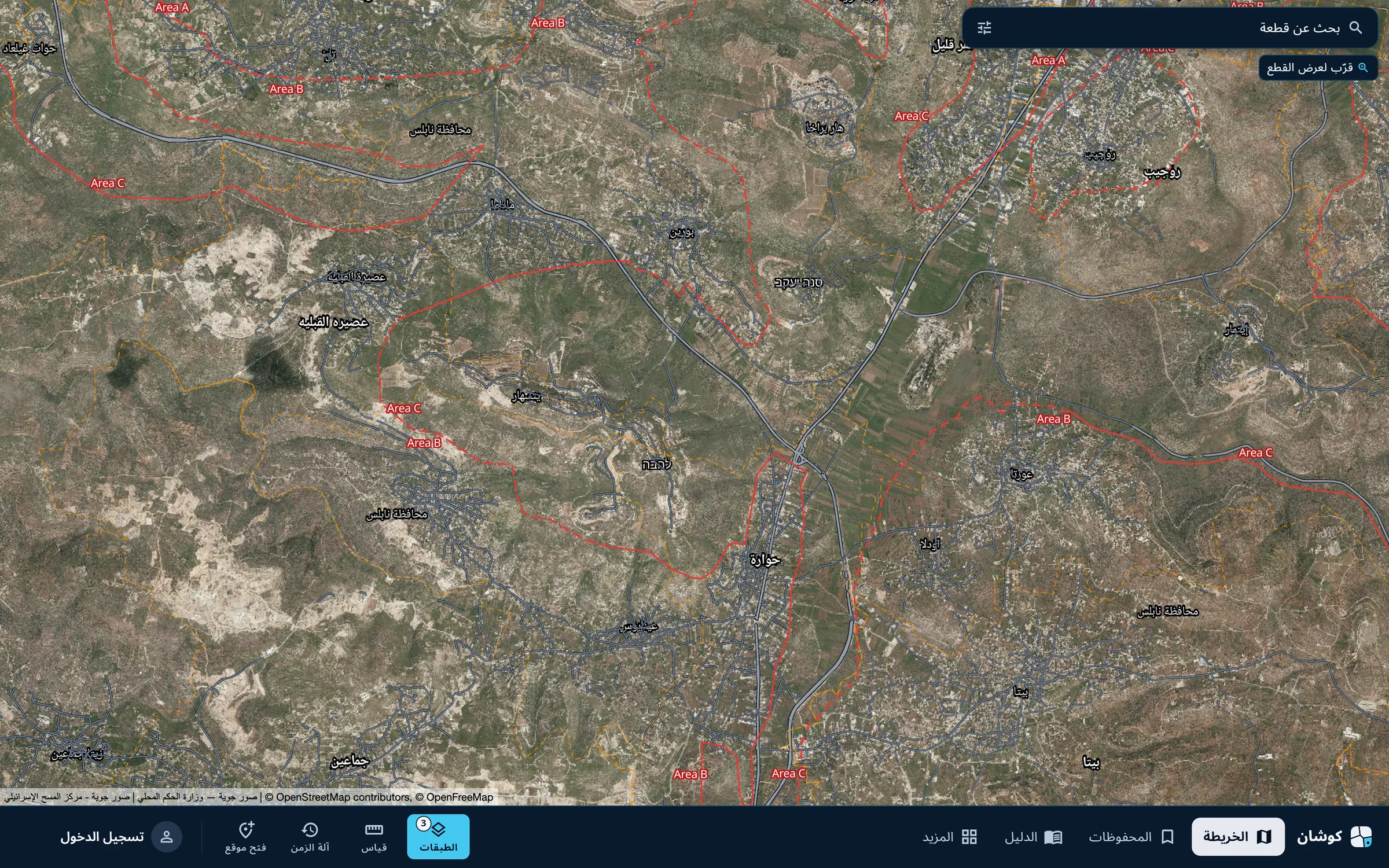
Open Layers
Press «الطبقات» (Layers) in the bar at the bottom. The number beside it is the count of reference layers switched on.
-
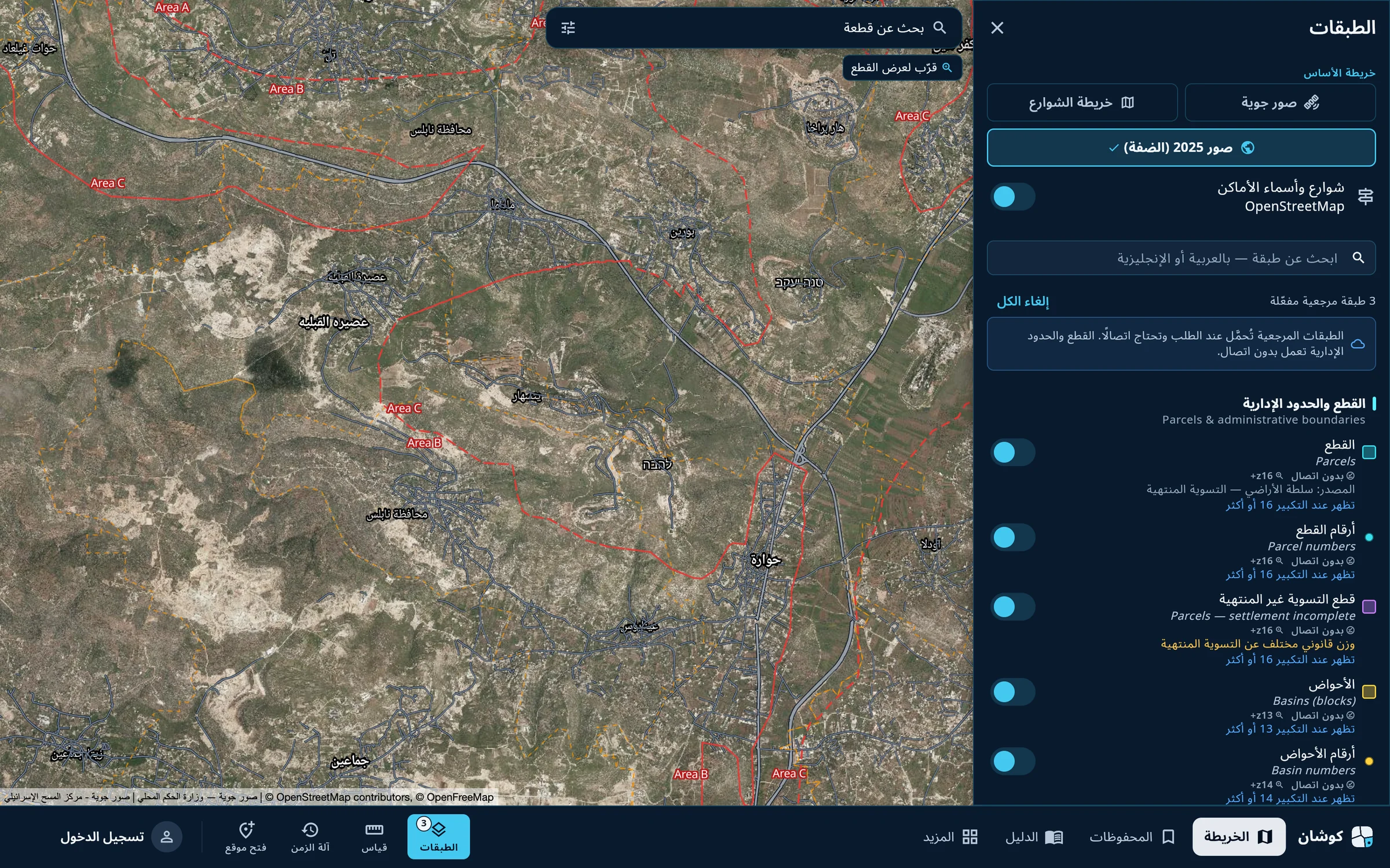
Search for the layer
At the top of the panel is the basemap: aerial imagery or street map. Below is a box to search for a layer in Arabic or English, then the layers in groups, each with its source and the zoom level at which it appears.
-
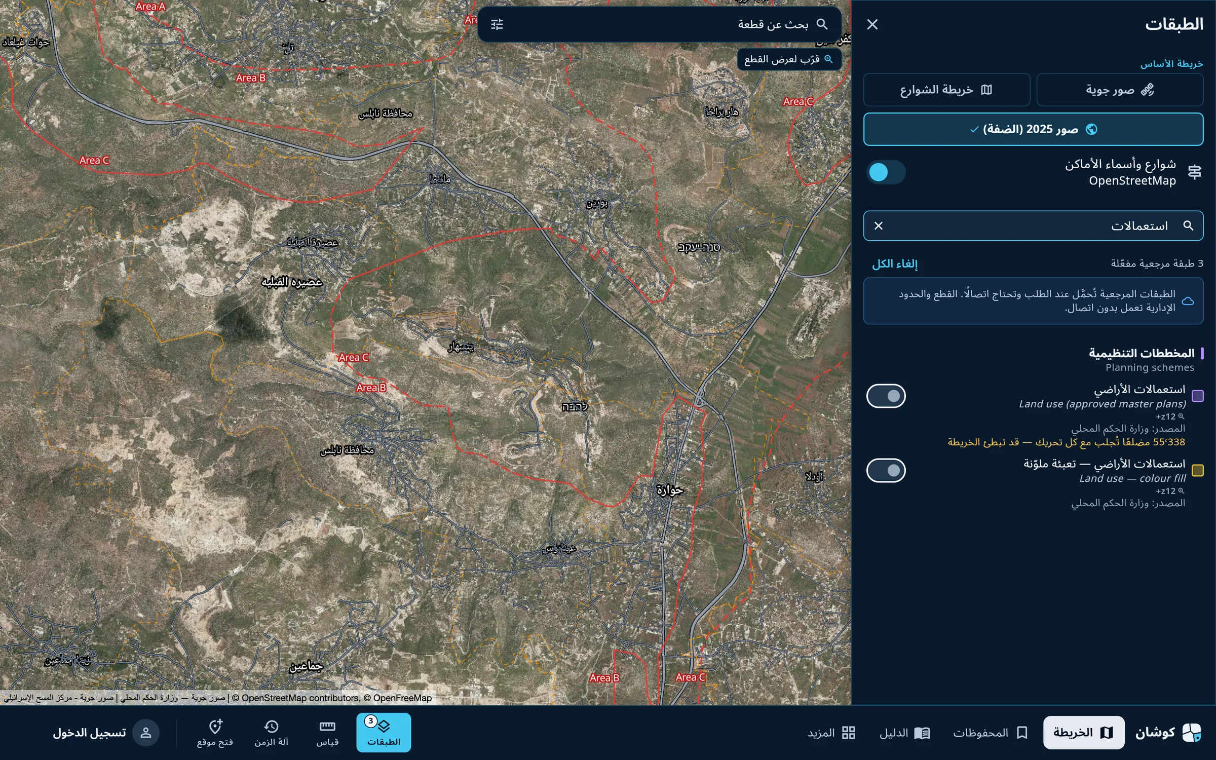
Switch it on
Type «استعمالات» and the two land-use layers appear: outlines only, or colour fill. Press the layer's switch.
-
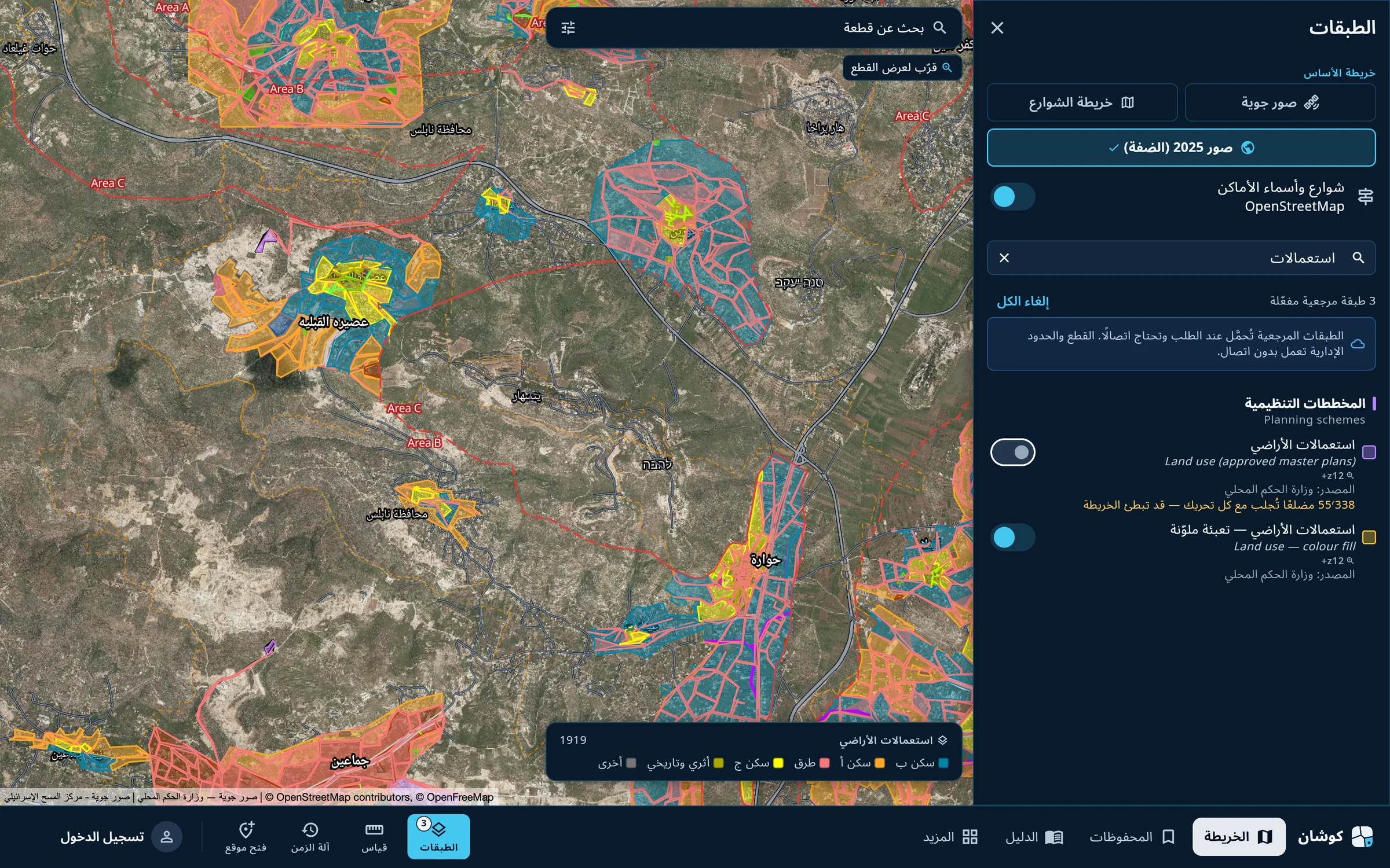
Close the panel
The layer loads and appears on the map at once. Close the panel with the close mark at its top.
-
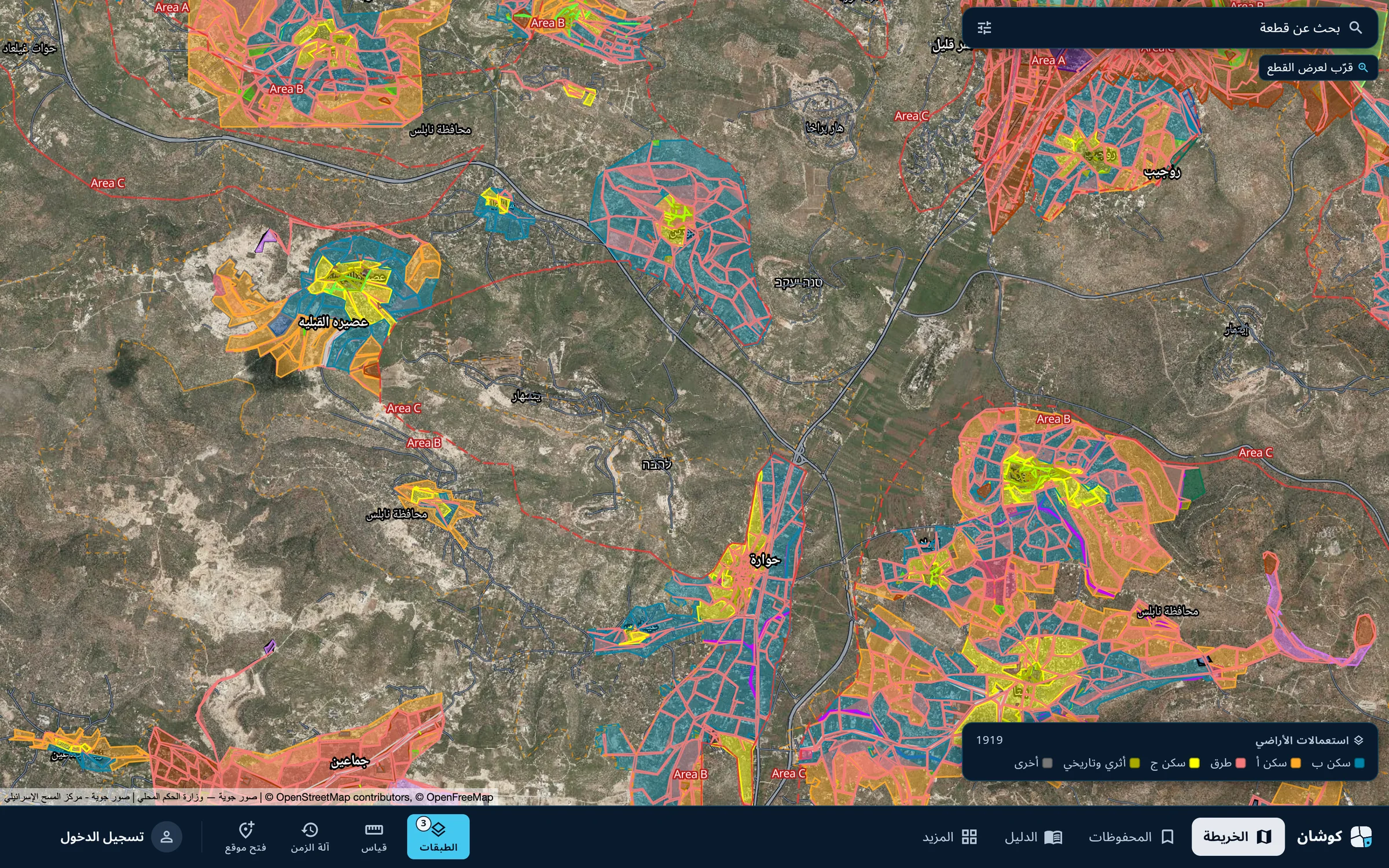
Read the colour key
A colour key appears at the bottom of the map: the layer's name, the count in view, and a colour for each class: Residential A, B and C, roads and others. The key changes with what is in view.
The full list of layers and their sources is on the map layers page. When too many plan zones are in view the app asks you to zoom in.
Qushan — the parcel data shown is administrative and geometric, and is not a legal record of ownership.