
Reading the parcel card
Pressing any parcel opens its card, with five sections: overview (نبذة), zoning (التنظيم), surroundings (المحيط), 3D model (المجسّم) and records (السجلات). The example is parcel 406, block 1, Sarra.
-
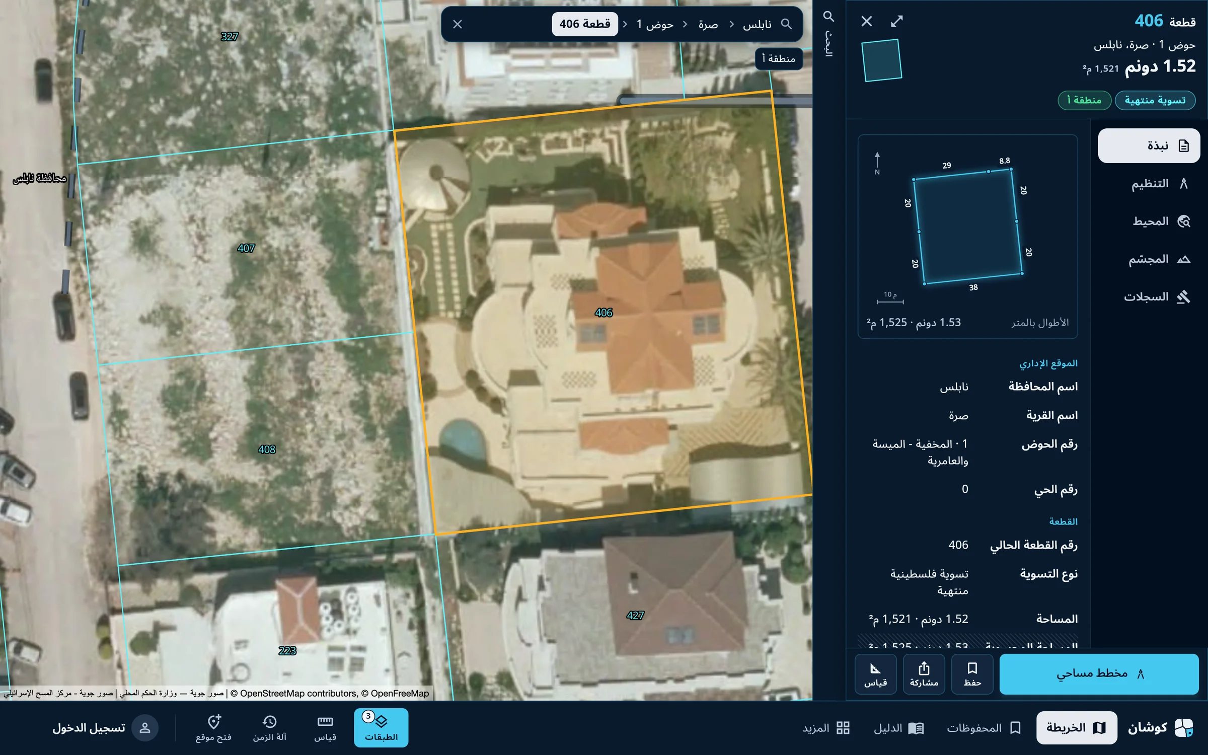
Overview
First come the parcel number, block and village, then badges for the land settlement type, the Area classification and the area. Below is the parcel outline with each side's length in metres, then the administrative location. The other sections are in the column beside the card: zoning, surroundings, 3D model, records.
-
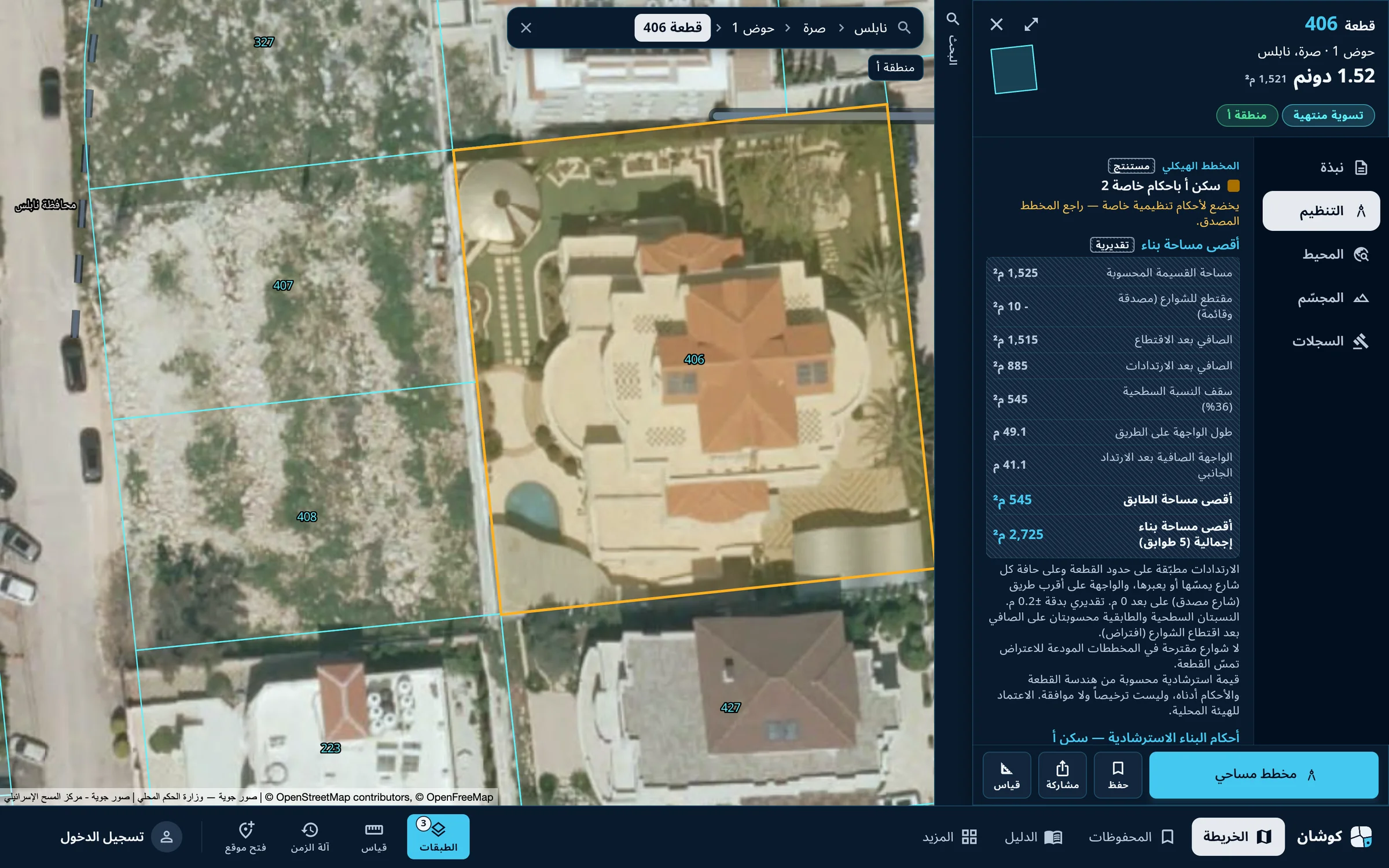
Zoning
The land use in the approved master plan, then an estimate of the maximum built area: plot area, the part taken by streets, the net after deductions and setbacks, and the frontage on the road. The figures are guidance; the approved plan is the reference.
-
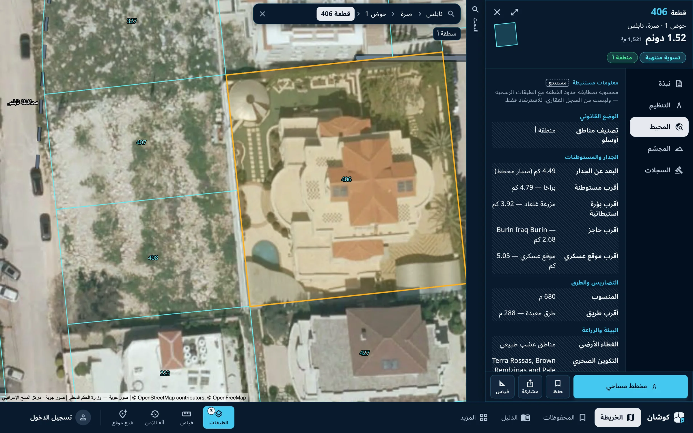
Surroundings
Information computed by matching the parcel boundary with published layers: Oslo classification, distance from the wall, the nearest Israeli settlement, outpost, checkpoint and military site, then terrain and roads. It is guidance, not part of the land register.
-
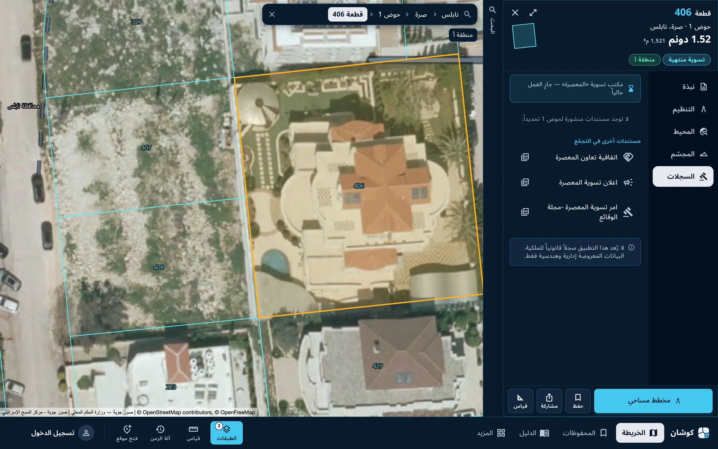
Records
The state of the settlement office in the locality, the settlement documents published for the block if any, and other documents for the locality: the settlement notice and the settlement order.
The «المجسّم» (3D model) section shows the parcel's terrain and buildings in three dimensions and is available to registered accounts. Residential classes are explained in the zoning guide, and settlement types in the land settlement guide.
Qushan — the parcel data shown is administrative and geometric, and is not a legal record of ownership.