
Hebron Governorate: villages, population and land
From Qushan data. Last updated 19 November 2026.
Hebron Governorate is one of the governorates of the West Bank; its centre is the city of Hebron. It had 711,223 inhabitants in the 2017 census, according to PCBS. It covers 1,000 km², according to PCBS. The census layer holds 117 localities in it, and Qushan's data holds 199,348 land parcels in 1,498 blocks. This page shows the map of the governorate, its towns and villages with their population, what the data holds about its land, its settlement of title, master plans, Areas A, B and C and what the occupation holds in it, and how to reach any parcel in it.
- Map
- Towns and villages
- Population and area
- Refugee camps
- Land and settlement of title
- Master plans
- Areas A, B and C
- Occupation and settlements
- Roads and buildings
- Terrain
- Neighbouring governorates
- External links
- Reaching a parcel
- Sources
- Area (2021)
- 1,000 km²
- Population (2017 census)
- 711,223
- Localities
- 117
- Land parcels
- 199,348
- Blocks
- 1,498
- Buildings (1997–2016)
- 53,334
Area: PCBS; Population: PCBS; other figures: Qushan, from the Ministry of Local Government geospatial portal, snapshot 16 November 2026.
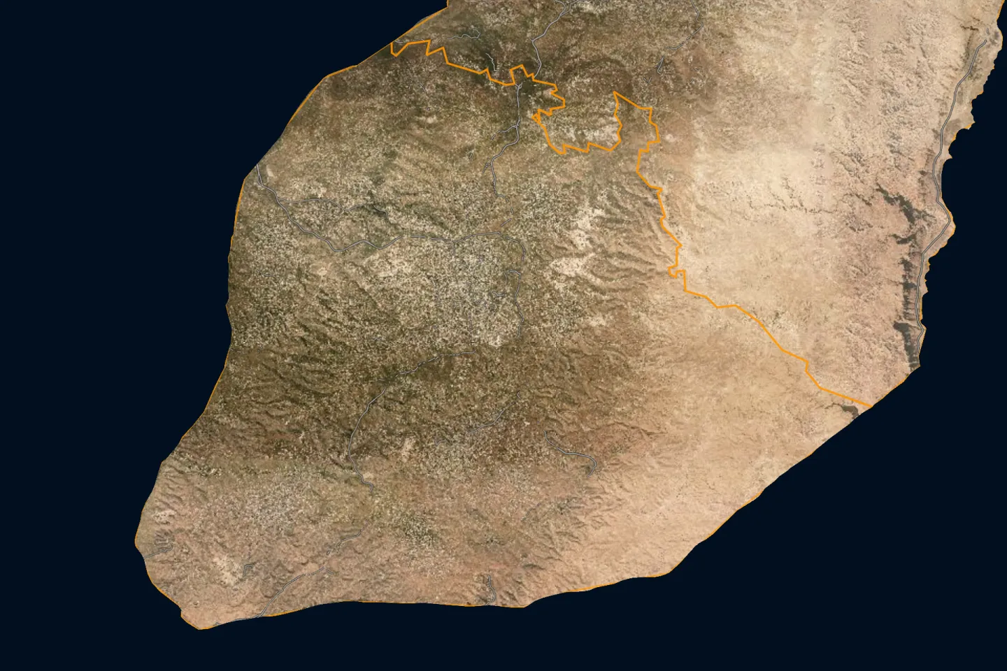
Map of Hebron Governorate and its localities
Open Hebron Governorate on the map
Towns and villages of Hebron Governorate
The 2017 census localities layer holds 117 localities in Hebron Governorate, listed here from the most populous. The population is what the layer states for each locality; the sum of these counts is not necessarily the official figure for the governorate.
| Locality | Population (2017 census) |
|---|---|
| Hebron (Al Khalil)الخليل | 201,063 |
| Yattaيطا | 63,511 |
| Duraدورا | 39,336 |
| Adh Dhahiriyaالظاهرية | 35,924 |
| Halhulحلحول | 27,031 |
| As Samu'السموع | 26,011 |
| Idhnaإذنا | 26,009 |
| Bani Na'imبني نعيم | 24,628 |
| Locality | Population (2017 census) |
|---|---|
| Sa'irسعير | 20,722 |
| Tarqumiyaترقوميا | 19,311 |
| Surifصوريف | 17,287 |
| Beit Ummarبيت أمر | 16,977 |
| Taffuhتفوح | 15,800 |
| Beit Ulaبيت أولا | 14,537 |
| Ash Shuyukhالشيوخ | 12,052 |
| Beit 'Awwaبيت عوا | 10,436 |
The other 101 localities
| Locality | Population (2017 census) |
|---|---|
| Al Karmilالكرمل | 9,740 |
| Kharasخاراس | 9,139 |
| Al 'Arrub Campمخيم العروب | 8,941 |
| Beit Kahilبيت كاحل | 8,880 |
| Deir Samitدير سامت | 8,114 |
| Al Fawwar Campمخيم الفوار | 7,641 |
| Ar Rihiyaالريحية | 5,754 |
| Nubaنوبا | 5,631 |
| Ar Ramadinالرماضين | 4,150 |
| As Suraالصرة | 3,941 |
| Beit 'Amraبيت عمرة | 3,607 |
| Khursaخرسا | 3,481 |
| Al Burj and Al Biraالبرج والبيرة | 3,205 |
| Khallet Edarخلة الدار | 2,984 |
| Rabudرابود | 2,816 |
| Hadab al Fawwarحدب ألفوار | 2,354 |
| Al Majdالمجد | 2,277 |
| Imreishإمريش | 2,208 |
| Khallet al Maiyyaخلة المية | 2,149 |
| Shuyukh al 'Arrubشيوخ العروب | 1,958 |
| Beit 'Einunبيت عينون | 1,928 |
| Deir al 'Asal al Fauqaدير العسل الفوقا | 1,859 |
| Karmaكرمة | 1,781 |
| Qalqasقلقس | 1,709 |
| Umm Lasafa and Abu Shabbanأم لصفا وابو شبان | 1,648 |
| Al Bouaierah (Aqabat Injeleh)البويرة (عقبة انجيلة) | 1,532 |
| El Kaumألكوم | 1,464 |
| Al Ka’abneh -Om Adaraj (Alzoyedeen)الكعابنه - أم الدرج (الزويدين) | 1,464 |
| Al Bouaierah (Al Baq'a)البويرة (البقعة) | 1,389 |
| Beit ar Rush al Fauqaبيت الروش الفوقا | 1,385 |
| Kuzibaكوازيبا | 1,383 |
| Ar Rifa'iyya and Ad Deiratالرفاعية والديرات | 1,312 |
| Hittaحتا | 1,155 |
| Beit Maqdumبيت مقدوم | 1,109 |
| Qla’a Zetaقلاع زيتا | 1,086 |
| Zifزيف | 1,061 |
| Khashem Adaraj (Al-Hathaleen)خشم الدرج (الهذالين) | 989 |
| Wadi 'Ubeidوادي عبيد | 976 |
| Kurzaكرزة | 943 |
| Sikkaسكة | 914 |
| Al Muwarraqالمورق | 839 |
| Wadi ash Shajinaوادي الشاجنة | 762 |
| Al Buweibالبويب | 734 |
| Umm al Khairأم الخير | 686 |
| Tarramaطرامة | 642 |
| Deir al 'Asal at Tahtaدير العسل التحتا | 616 |
| Umm Ashoqhanأم الشقحان | 605 |
| Masafer Bani Na'im) Khallet Al Masafer (مسافر بني نعيم (خلة المسافر) | 567 |
| 'Anab al Kabirعناب الكبير | 463 |
| An Najadaالنجادة | 449 |
| 'Arab al Fureijatعرب الفريجات | 431 |
| Locality | Population (2017 census) |
|---|---|
| Beit ar Rush at Tahtaبيت الروش التحتا | 428 |
| Beit Mirsimبيت مرسم | 417 |
| Umm Al Amad (Sahel Wadi Elma)أم العمد (سهل واد الماء) | 400 |
| Jalaجالا | 372 |
| Khirbet ad Deirخربة الدير | 358 |
| Qinan Jaberقنان جابر | 349 |
| Khirbet al Fakheitخربة الفخيت | 312 |
| Edqeqa (Khirbet Tawil ash Shih)إدقيقة( خربة طويل الشيح) | 301 |
| Marah al Baqqarمراح البقار | 299 |
| Deir Razihدير رازح | 294 |
| Khirbet Shuweikaخربة شويكة | 282 |
| Imneizilإمنيزل | 278 |
| Somaraسومرة | 244 |
| Wadi ar Rimوادي الريم | 224 |
| Iskeikإسكيك | 212 |
| Tawasطواس | 204 |
| Sosyaسوسيا | 199 |
| At Tuwaniالتواني | 194 |
| Shi'b al Batimشعب البطم | 177 |
| Qinan an Namirقنان النمر | 159 |
| Al'enالعين | 157 |
| Khashem al Karemخشم الكرم | 151 |
| Birinبيرين | 150 |
| Subaسوبا | 139 |
| Tarusaطاروسة | 139 |
| Khirbet Bir al 'Iddخربة بير العد | 135 |
| Khirbet Zanutaخربة زنوتة | 131 |
| Majd AlBa'مجد الباع | 123 |
| Umm al Butmأم البطم | 82 |
| Khirbet Deir Shamsخربة دير شمس | 80 |
| Tobaطوبا | 76 |
| Khirbet Asafi (Al Fauqa and Al Tahta)خربة اصفي (الفوقا و التحتا) | 73 |
| Almefqaraالمفقرة | 73 |
| Humsaحمصة | 64 |
| Khirbet Ghuwein al Fauqaخربة غوين الفوقا | 55 |
| Hamrushحمروش | 53 |
| Khirbet ar Rahwaخربة الرهوة | 51 |
| Wadi al Kilabوادي الكلاب | 49 |
| Al Maq'oraالمقعورة | 45 |
| Sadit athalehسدة الثعلة | 45 |
| Haribat an Nabiهريبة النبي | 41 |
| Qawawisقواويس | 31 |
| Kafr Julكفر جول | 19 |
| Khirbet al Kharabaخربة الخرابة | 17 |
| Khirbet Alrthemخربة الرظيم | 16 |
| Maghayir al 'Abeedمغاير العبيد | 16 |
| Ar Rakeezالركيز | 15 |
| Iqtetإقطيط | 8 |
| Khirbet Jamruraخربة جمرورة | — |
| Abu Alhanaأبو الحنا | — |
Source: the 2017 census localities layer as published on the geospatial portal of the Ministry of Local Government, which the Qushan app shows as "Population density".
The population of the governorates is compared on the population page.
A dash means the layer gives no population for the locality. The list holds Palestinian localities only. Israeli settlements are not part of it; what concerns them is in the occupation section below.
Population and area of Hebron Governorate
Figures of the Palestinian Central Bureau of Statistics (PCBS) for Hebron Governorate:
Refugee camps in Hebron Governorate
The camps that PCBS lists under Hebron Governorate, with its mid-2017 population estimate. This is a mid-year estimate, not the census count, so it differs slightly from the figure in the table above.
| Camp | Population (mid-2017 estimate) |
|---|---|
| Al A’rrub Camp | 8,863 |
| Al Fawwar Camp | 7,575 |
Source: PCBS, 2017.
Land and settlement of title
Qushan's data for Hebron Governorate holds 199,348 land parcels in 1,498 blocks. Each parcel has its boundary on the map, its block number and parcel number, its area, its land settlement type, and its land use in the master plan where an approved plan exists.
Parcels by land settlement type
For each parcel the app states its land settlement type, that is, the state of settlement of title. The parcels in Hebron Governorate divide as follows:
| Settlement type | Parcels |
|---|---|
| Palestinian settlement of title, completed تسوية فلسطينية منتهية | 132,028 |
| Assessment blocks (takhmin) احواض تخمين | 39,046 |
| Jordanian settlement of title, not completed تسوية أردنية غير منتهية | 12,723 |
The figures are what the app's data held on 13 November 2026; they are not official statistics. The data does not include all unsettled land, because the parcels of some blocks are not yet drawn in the source.
What these types mean, and their effect, is in the land settlement and tabu guide.
Share of parcels with completed settlement
Settlement of title is completed for 19.8% of the parcels of Hebron Governorate in the parcels layer; the layer counts 50,845 registered parcels covering 126 km².
Source: Qushan, from the Ministry of Local Government geospatial portal, snapshot 16 November 2026.
Completed and uncompleted settlement, by area
Source: Qushan, from the Ministry of Local Government geospatial portal, snapshot 16 November 2026. Survey year: not stated in the source.
| Status | Area | % |
|---|---|---|
| Settlement not completed | 41.5 km² | 32.9 |
| Settlement completed | 4.1 km² | 3.3 |
| Unspecified | 80.5 km² | 63.8 |
Registered and unregistered land
Source: Qushan, from the Ministry of Local Government geospatial portal, snapshot 16 November 2026. Survey year: not stated in the source.
Shares are of community land in the app's layer, not of the official area of the governorate.
| Status | Area | % |
|---|---|---|
| Registered | 53.6 km² | 5.3 |
| Not registered | 964 km² | 94.7 |
Localities with the most parcels
Locality names are given in Arabic, as they appear in the app.
| Locality | Parcels |
|---|---|
| الخليل | 24,865 |
| دورا الخليل | 21,087 |
| حلحول | 18,504 |
| يطا | 14,944 |
| بيت أمر | 11,368 |
| السموع | 10,666 |
| ترقوميا | 10,035 |
| تفوح | 9,282 |
| دورا | 8,561 |
| الشيوخ | 8,302 |
| اذنا | 8,150 |
| صوريف | 7,484 |
The data also holds parcels in: الظاهرية، بني نعيم، بيت كاحل، سعير، خاراس، نوبا، بيت اولا، الكرمل، يطا - خلة المي، خلة المي، توانه، ام الدرج، دورا - بيت مرسم، النجادة، دورا - البرج و البيره، الرماضين، دورا - بيت الروش التحتا، جمرورة، دورا - دير العسل الفوقا، خربة جمرورة، امنيزل، دورا-المجد، دورا - ابو العرقان، دورا - دير سامت، دورا-عبدة، دورا-سكة،طواس، دير العسل الفوقا.
Source: Qushan, from the Ministry of Local Government geospatial portal, snapshot 13 November 2026.
Master plans and land use
| Item | Value |
|---|---|
| Land inside an approved master plan | 218 km² |
| Plans deposited for public objection | 47.5 km² |
The source states no survey year for these figures.
Source: Qushan, from the Ministry of Local Government geospatial portal, snapshot 16 November 2026.
Largest land-use classes by area
Source: Qushan, from the Ministry of Local Government geospatial portal, snapshot 16 November 2026. Survey year: not stated in the source.
Class names are shown in Arabic, as the source publishes them.
| Class | Area |
|---|---|
| سكن أ | 75.6 km² |
| سكن ب | 46.5 km² |
| سكن زراعي | 27.2 km² |
| شارع مصدق | 20.5 km² |
| سكن ج | 13.6 km² |
| منطقة صناعية | 6.23 km² |
| منطقة البلدة القديمة | 3.76 km² |
| منطقة زراعية | 3.7 km² |
| سكن د | 3.04 km² |
| مباني عامة | 2.96 km² |
The approved plans of Hebron Governorate use 62 classes; the table shows the ten largest.
What the classes mean, and the building rules, are in the master plans and residential classes guide.
Areas A, B and C
How the community land of Hebron Governorate divides among the Oslo classifications. Shares are of community land in the app's layer, not of the official area of the governorate.
Source: Qushan, from the Ministry of Local Government geospatial portal, snapshot 16 November 2026. Survey year: 1995.
| Classification | Area | % |
|---|---|---|
| Area A | 234 km² | 24.6 |
| Area B | 239 km² | 25.1 |
| Area C | 480 km² | 50.4 |
What each classification means is in the guide to Areas A, B and C.
Occupation and settlements
What the published layers state about Israeli settlements and military sites inside Hebron Governorate. Each figure carries its survey year and describes that year, not today.
| Item | Value | Survey year |
|---|---|---|
| Fenced area of Israeli settlements | 8.56 km² | 2016 |
| Settlement outposts | 16 | not stated in the source |
| Settlement industrial areas | 4 | 2016 |
| Military bases | 10 | not stated in the source |
| Road length under Israeli control | 130 km | 2014–2016 |
Source: Qushan, from the Ministry of Local Government geospatial portal, snapshot 16 November 2026.
Settler population
Source: Qushan, from the Ministry of Local Government geospatial portal, snapshot 16 November 2026. Survey year: 2014.
| Year | Settlers |
|---|---|
| 2012 | 17,422 |
| 2013 | 17,560 |
| 2014 | 17,787 |
Where the settlements, the wall and the checkpoints lie on the map is in the guide to settlements, the wall and checkpoints.
Roads and buildings
| Item | Value | Survey year |
|---|---|---|
| Classified road length | 767 km | 2014–2016 |
| Roads needing full rehabilitation | 67.7 km | 2014–2016 |
| Buildings | 53,334 | 1997–2016 |
| Building footprint | 8.76 km² | 1997–2016 |
| Mosques | 616 | not stated in the source |
| Documented place names | 2,394 | not stated in the source |
Source: Qushan, from the Ministry of Local Government geospatial portal, snapshot 16 November 2026.
Terrain
The lowest elevation in Hebron Governorate is 200 m above sea level and the highest 1,000 m above sea level, according to the contour lines in the source.
- Lowest elevation
- 200 m
- Highest elevation
- 1,000 m
Source: Qushan, from the Ministry of Local Government geospatial portal, snapshot 16 November 2026. Survey year: not stated in the source.
Neighbouring governorates
By the governorate outlines in the app, Hebron Governorate borders: Bethlehem.
Pages of the other governorates: Jenin, Tubas, Tulkarm, Nablus, Qalqilya, Salfit, Ramallah & Al-Bireh, Jericho & Al-Aghwar, Jerusalem, North Gaza, Gaza, Deir al-Balah, Khan Yunis, Rafah. The governorates are compared in the land statistics and on the land maps by governorate page.
External links
Reaching a parcel in Hebron
- Open the map and press the bar «بحث عن قطعة» (“search for a parcel”).
- Choose the governorate: الخليل, then the village, then the block.
- Enter the parcel number and press «بحث و تقريب» (“search and zoom”).
The full steps, and what to do when you do not know the number, are in the guide to finding a parcel by block and parcel number.
What you find for each parcel
- Record: locality, block, parcel number, area, land settlement type and Area classification.
- Zoning: land use in the master plan and the guidance building rules. Details are in the master plans and residential classes guide.
- Surroundings: length of road frontage, distance from the wall and from the nearest Israeli settlement, and nearby services.
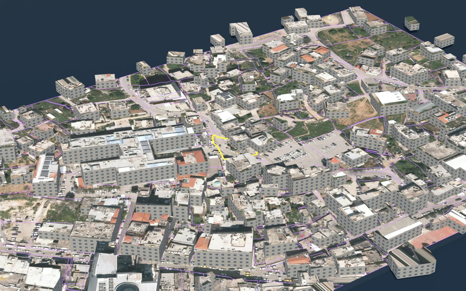
- Outputs: a survey plan in DXF, a PDF report and a 3D model.
Limits and sources
- Qushan is an independent app, not a government product. It shows published administrative and engineering data, and it is not a legal record of ownership.
- Parcel data does not include the owner's name, and the app shows no land for sale and no prices.
- The app's figures are computed from the published layers as they are, with their dates and coverage. They are not official statistics. Some layers are old: the survey year is given with each figure, and the value describes that year, not today.
- Parcels, blocks and settlement types: Qushan, from the Ministry of Local Government geospatial portal, snapshot 13 November 2026.
- Indicators, areas and lengths: Qushan, from the Ministry of Local Government geospatial portal, snapshot 16 November 2026.
- Locality boundaries and their population counts: the 2017 census localities layer as published on the geospatial portal of the Ministry of Local Government.
- PCBS, Population, Housing and Establishments Census 2017: Final Results Summary (updated July 2018), Table 2, p. 71 (2017).
- PCBS, Estimated Population in Palestine Mid-Year by Governorate, 1997-2026 (2026).
- PCBS, Area, Population and Population Density in Palestine by Governorate, 2021 (area from Ministry of Local Government, 2017) (2021).
- PCBS, Projected Mid-Year Population by Locality 2017-2026 (rows named Camp) (2017).
Qushan — the parcel data shown is administrative and geometric, and is not a legal record of ownership.